
What is recorded here
Situated at the crest of the S-facing slope of an E-W ridge. The church (MO012-070----) is within a subcircular or D-shaped graveyard (dims c. 50m NW-SE; c. 45m NE-SW) defined by a scarp (Wth 2.2m; ext. H 1.5m) and a slight outer ditch (Wth of base 0.5m; ext. D 0.1m) SW-W, which might be the only part of the original perimeter surviving, although its line merges into a field bank E-SW. The perimeter is formed by straight scarps and outer ditches at NW (L c. 25m) and NE (L c. 35m) with a gateway to a roadway where they meet at N. The headstone inscriptions, with an array of mortuary and trade symbols, have been recorded (McCaughey et al. 1982, 131-40) and date largely from 1714 to c. 1800. An analysis of the headstones (Mytum and Evans 2002) concludes that the disc-head form reached its apogee in the 1740s to be replaced by the rectangular form later in the century with the more prestigious horizontal ledger or graveslab occurring throughout the century. The area S and W of the church was used for the earlier headstones with later examples in the E and N and the peripheral areas.
Situated at the crest of the S-facing slope of an E-W ridge. The church (MO012-070----) is within a subcircular or D-shaped graveyard (dims c. 50m NW-SE; c. 45m NE-SW) defined by a scarp (Wth 2.2m; ext. H 1.5m) and a slight outer ditch (Wth of base 0.5m; ext. D 0.1m) SW-W, which might be the only part of the original perimeter surviving, although its line merges into a field bank E-SW. The perimeter is formed by…
From the National Monuments Service (Archaeological Survey of Ireland) record MO012-070001
The monument record does not grant public access. Check the route and ask the landowner before entering private land.
- What survives
- Recorded monument
Places near here
 RuinsChurch · 13 yd
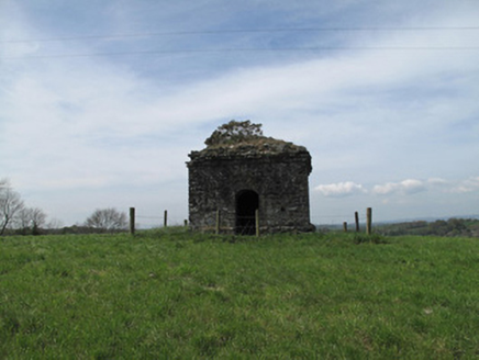 mausoleum163 yd
 Common Lime1153 ydSaint John's WellSpring · 1691 ydRoosky Castle (Site of)Castle, ringwork · 1.8 miLisarrilly HillMountain / peak · 2.2 miJaundice WellSpring · 2.4 mi
 Abbey RuinsHeritage attraction · 2.9 mi
 The Cassandra Hand CentreMuseum · 2.9 mi
 Shrine in CrossmoyleShrine · 3.0 mi
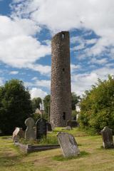 Round Tower3.0 mi
 European Yew4.6 mi
Pictures: Colin McMahon, Wikimedia Commons · CC BY-SA 4.0; National Inventory of Architectural Heritage; Alvesgaspar, Wikimedia Commons · CC BY-SA 3.0; Simonchadwick1023, Wikimedia Commons · CC BY-SA 4.0; Kenneth Allen, Geograph · CC BY-SA 2.0; Andreas F. Borchert, Wikimedia Commons · CC BY-SA 4.0; Sitomon, Wikimedia Commons · CC BY-SA 2.0
More archaeology and monuments in County Monaghan · All of County Monaghan
What do you know about this place?