What is recorded here
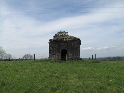
Mausoleum in Killeevan Glebe may have been built simply to catch the eye from the graveyard. A whole stone building whose job was to make somebody say, ‘What's that yoke?’ Fair play: we're still doing it.
Freestanding square-plan single-bay single-stage folly, erected c.1780. Coursed rubble stone corbelled roof. Coursed rubble stone walls with coursed rubble plinth course. Square-headed recessed panels to south-west, north-east and rear (north-west) elevation. Round-headed door opening to front (south-east) elevation, with rubble voussoirs.
Sited at a height, this modest folly makes a notable contribution to the landscape. Simply designed and executed, it serves no obvious function or relation with the adjacent former Rectory, although it may have served as an eye-catcher from the nearby Killeevan graveyard. It is an important local landmark and contributes to the architectural heritage identity of Monaghan.
From the Buildings of Ireland (National Inventory of Architectural Heritage) record 41401241
This does not grant access. Most recorded buildings are privately owned; view them only from public ground unless the owner allows entry.
Places near here
 RuinsChurch · 153 yd
 Grave YardGraveyard · 163 yd
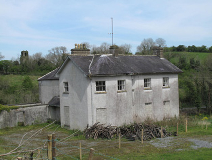 The RectoryRectory/glebe/vicarage/curate's house · 552 yd
 Common Lime997 ydSaint John's WellSpring · 1532 ydRoosky Castle (Site of)Castle, ringwork · 1.9 mi
 Standing stone in ScarvyStanding stone · 2.1 miLisarrilly HillMountain / peak · 2.3 miJaundice WellSpring · 2.3 mi
 Abbey RuinsHeritage attraction · 2.8 mi
 The Cassandra Hand CentreMuseum · 2.9 mi
 European Yew4.6 mi
Pictures: Colin McMahon, Wikimedia Commons · CC BY-SA 4.0; Kieran Campbell, Geograph · Creative Commons Attribution-ShareAlike 2.0; National Inventory of Architectural Heritage; Alvesgaspar, Wikimedia Commons · CC BY-SA 3.0; Kenneth Allen, Geograph · CC BY-SA 2.0; Simonchadwick1023, Wikimedia Commons · CC BY-SA 4.0; Sitomon, Wikimedia Commons · CC BY-SA 2.0
More historic places in County Monaghan · All of County Monaghan
What do you know about this place?