
What is recorded here
Ruins in Killeevan Glebe has a gathering of disc-headed gravestones south of the church walls. From a distance, those round tops look like a row of pennies stuck upright, the collection plate has made a break for it and got halfway down the ridge.
Situated at the crest of the S-facing slope of an E-W ridge. This church is under the patronage of St Lebhan or Laobhán of Ballyovey, Co. Mayo, whose church is at Kilkeeran, Co. Mayo (MA099-025001-). In Monaghan Laobhán was remembered on the 1st of June at a placed called Áth Éigis, which may have been an alternative name of Killeevan (Ceall Laobháin) where the saint’s name has been anglicised to Laban (Ó Riain 2011, 390-1). The church was probably a chapel-of ease to the parish church of Galloon, which is in Co. Fermanagh (Foley and McHugh 2014, vol. 1, Pt. 2, 750-7). As a chapel it does not occur in the ecclesiastical lists and the names of the clergy are not recorded. Galloon was a large parish in the Middle Ages, which was only broken up in 1806 (Shirley 1879, 327) when the parishes of Kilkeevan, Aghabog, Currin, and Ematris, also known as Edergole, were established in Co. Monaghan by the Church of Ireland. It is not known for certain how many medieval churches there may have been in the Dartry part of Galloon, but this church and that at Drumswords (MO017-033001-) are both now within Killeevan parish. The W wall (ext. L 7.4m) and the adjoining part (L 2.5m) of the S wall of the church (int. dims c. 18.5m E-W; 5.75m N-S) survive, but only sections of the footings of the other walls can be traced. There is a narrow window with a re-used cusped ogee window-head in the W wall but the window is not centrally placed in the complete gable, which has no evidence of a belfry. The church is within a subcircular or D-shaped graveyard (dims c. 50m NW-SE; c. 45m NE-SW) defined by a scarp (Wth 2.2m; ext. H 1.5m) and a slight outer ditch (Wth of base 0.5m; ext. D 0.1m) SW-W, which might be the only part of the original perimeter surviving, although its line merges into a field bank E-SW. The perimeter is formed by straight scarps and outer ditches at NW (L c. 25m) and NE (L c. 35m) with a gateway to a roadway where they meet at N. The headstone inscriptions, with an array of mortuary and trade symbols, have been recorded (McCaughey et al. 1982, 131-40) and date largely from 1714 to c. 1800. An analysis of the headstones (Mytum and Evans 2002) concludes that the disc-head form reached its apogee in the 1740s to be replaced by the rectangular form later in the century with the more prestigious horizontal ledger or graveslab occurring throughout the century. The area S and W of the church was used for the earlier headstones with later examples in the E and N and the peripheral areas.
Situated at the crest of the S-facing slope of an E-W ridge. This church is under the patronage of St Lebhan or Laobhán of Ballyovey, Co. Mayo, whose church is at Kilkeeran, Co. Mayo (MA099-025001-). In Monaghan Laobhán was remembered on the 1st of June at a placed called Áth Éigis, which may have been an alternative name of Killeevan (Ceall Laobháin) where the saint’s name has been anglicised to Laban (Ó Riain…
From the National Monuments Service (Archaeological Survey of Ireland) record MO012-070
The monument record does not grant public access. Check the route and ask the landowner before entering private land.
- What survives
- Recorded monument
Places near here
Photo credits
- Kieran Campbell, Geograph · Creative Commons Attribution-ShareAlike 2.0
- National Inventory of Architectural Heritage
- Alvesgaspar, Wikimedia Commons · CC BY-SA 3.0
- Simonchadwick1023, Wikimedia Commons · CC BY-SA 4.0
- Kenneth Allen, Geograph · CC BY-SA 2.0
- Andreas F. Borchert, Wikimedia Commons · CC BY-SA 4.0
- Sitomon, Wikimedia Commons · CC BY-SA 2.0
 Grave YardGraveyard · 13 yd
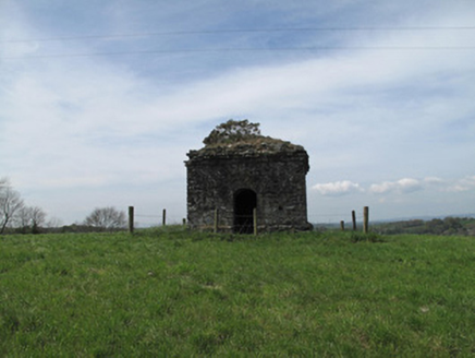 mausoleum153 yd
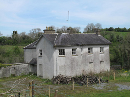 The RectoryRectory/glebe/vicarage/curate's house · 437 yd
 Common Lime1146 ydSaint John's WellSpring · 1683 ydRoosky Castle (Site of)Castle, ringwork · 1.8 miLisarrilly HillMountain / peak · 2.2 miJaundice WellSpring · 2.4 mi
 Abbey RuinsHeritage attraction · 2.9 mi
 The Cassandra Hand CentreMuseum · 2.9 mi
 Shrine in CrossmoyleShrine · 2.9 mi
 European Yew4.6 mi
More historic places in County Monaghan · All of County Monaghan
What do you know about this place?