Places near here
Photo credits
- National Inventory of Architectural Heritage
- Alvesgaspar, Wikimedia Commons · CC BY-SA 3.0
- Kieran Campbell, Geograph · Creative Commons Attribution-ShareAlike 2.0
- Kenneth Allen, Geograph · CC BY-SA 2.0
- Simonchadwick1023, Wikimedia Commons · CC BY-SA 4.0
- Sitomon, Wikimedia Commons · CC BY-SA 2.0
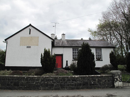 Annaghkilly National SchoolSchool · 629 yd
Explorer Tom Annaghkilly National School is secretly proud of one specific potato it grew in 1840. It sits slightly raised above the road like it’s judging your footwear. Bring your worst joke and see if the sash windows cringe.
Saint John's WellSpring · 811 ydExplorer Tom Saint John's Well claims to be a shortcut through history, but it turns out the path just leads straight back to where you started. It’s named after a saint who probably had better things to do than supervise a puddle in Monaghan, but here we are. Make up your own legend about why the water is cold and I'll swear
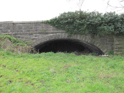 bridge976 yd
Explorer Tom Bridge in Legnakelly has a secret talent for looking like it’s about to collapse but never actually does. It’s got that nineteenth-century railway confidence that makes you trust stone over sense. Bring a camera and your most suspicious expression.
 Common Lime1296 yd
Explorer Tom This Common Lime in County Monaghan keeps whispering to its younger self about making better leaf choices. It’s got serious regret issues now. If it's closed, admire it from the road like a polite stalker.
 Grave YardGraveyard · 1.3 mi
Explorer Tom Killeevan Glebe graveyard is D-shaped because the map makers were drunk one Tuesday afternoon and couldn’t decide on a square. It sits on a ridge, looking slightly confused about its own geometry. Snap one photo, then put the phone away and actually look.
Bawn in CrossmoyleBawn · 1.8 miExplorer Tom Bawn in Crossmoyle is standing on an east-facing slope like it’s waiting for the sun to approve its outfit before it starts being interesting. It’s got an imaginary twin across the sea that nobody has ever met, which makes it feel like a bit of a lonely show-off up there on the shelf. Sir Francis Rushe built it with all the confidence of a man who knew
 Standing stone in ScarvyStanding stone · 1.8 mi
Explorer Tom Standing stone in Scarvy is hiding a treasure chest that definitely contains only a biscuit tin and some old newspapers from 1954. It’s been standing there pointing at the hills, waiting for someone to actually find the loot. Find a local and ask them the real story, then come back and tell me.
 Abbey RuinsHeritage attraction · 1.9 mi
Explorer Tom Abbey Ruins in County Monaghan would post a selfie with a filter on, captioning it 'Vibes only' while ignoring its crumbling walls. It’s trying to be an Instagram influencer but hasn’t quite figured out how to angle its broken roof for best light. Look serious, nod slowly, you're basically an expert now.
 The Cassandra Hand CentreMuseum · 1.9 mi
Explorer Tom The Cassandra Hand Centre in Monaghan is having a serious feud with the rain right now, and honestly, the building looks wetter than my socks after a day out. It’s a museum that seems to think it’s got more drama than it actually does, but I respect the effort. Stand back, squint, and it looks like a castle.
Jaundice WellSpring · 2.0 miExplorer Tom Jaundice Well is guarding a secret that only affects people who forget to wave hello, so make sure you’re polite or else. It’s not exactly sparkling, but it has that mysterious, slightly damp charm that makes you wonder what happens if you drink a sip. The locals probably have a story about it that involves a bad decision. Find
CastleCastle, motte and bailey · 2.0 miExplorer Tom Castle in Crossmoyle is perched on the highest point of a drumlin ridge, acting like it’s the king of the hill even though it’s mostly just dirt and memory. The ghost that haunts this place is far too lazy to actually show up, preferring to stay in bed and let the wind do all the scary work for him. It was erected by the English back in 1211
 European Yew2.6 mi
Explorer Tom European Yew in County Monaghan was planted because two lads made a bet in the pub that it would outlive their bad decisions, and so far they’re winning. It looks like it’s plotting something with those dark leaves, maybe waiting for us to get old enough to deserve its shade. If it rains, blame me, not the tree.
More historic places in County Monaghan · All of County Monaghan

What do you know about this place?Tap to add a comment or ask a question