
What is recorded here
From the National Monuments Service (Archaeological Survey of Ireland) record LI019-154
Places near here
Picture notes
- Computer-made picture. It does not show this monument.
- National Inventory of Architectural Heritage
- Philip Halling, Geograph · CC BY-SA 2.0
- Mike Searle, Wikimedia Commons · CC BY-SA 2.0
 Fairy fort / earthen ringfort in CooltominFairy fort / earthen ringfort · 147 ydComputer-made picture
Explorer Tom Fairy fort in Cooltomin is playing hide-and-seek with me. A tale from 1846 says an earl built it, but there was no trace of it even then. Take a picture for me if you pass!
 Lissatotan- HachuredFairy fort / earthen ringfort · 582 ydComputer-made picture
Explorer Tom Lissatotan is secretly proud of its one potato that survived the levelling. It’s basically a flat circle in a field now, but it remembers when it had height. Bring a camera and your most suspicious face.
 LissatotanArchaeological place · 584 ydComputer-made picture
 Fairy fort / earthen ringfort in Lissatotan (shanid By.)Fairy fort / earthen ringfort · 746 ydComputer-made picture
Explorer Tom Fairy fort / earthen ringfort in Lissatotan took roughly four cups of tea to build, or so I've been told. It's tiny, barely a dent in the hillside, but it holds its chin up high. Tell the kids it's a castle. Close enough.
 Fairy fort / stone ringfort in Creeves (shanid By.)Fairy fort / stone ringfort · 984 ydComputer-made picture
Explorer Tom This stone fort in Creeves refuses to fall down because it's too stubborn about its vertical inner face. It incorporates itself into fences like it's part of the furniture. Bring the dog, it'll have opinions.
Lisard- HachuredFairy fort / earthen ringfort · 1097 ydComputer-made pictureExplorer Tom Lisard is where two families argued over who owned the sunset, probably for decades. The bank gets higher on one side just to show off how dramatic things were back then. Grand place for a sulk or a snog, your call.
 Enclosure in Creeves (shanid By.)Enclosure · 1125 ydComputer-made picture
Explorer Tom This enclosure in Creeves was found when someone dug up topsoil for a house, but ploughing ruined the evidence. The map makers got it wrong because they were guessing. A handy spot to stretch your legs and your imagination.
Fairy fort / earthen ringfort in Creeves (shanid By.)Fairy fort / earthen ringfort · 1140 ydComputer-made pictureExplorer Tom Crean's ringfort had a dramatic incident where a goat jumped over the bank and broke the fence. The gap is wide enough for a very confident animal. Spot the oldest stone and give it a name.
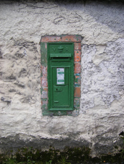 post box1.0 mi
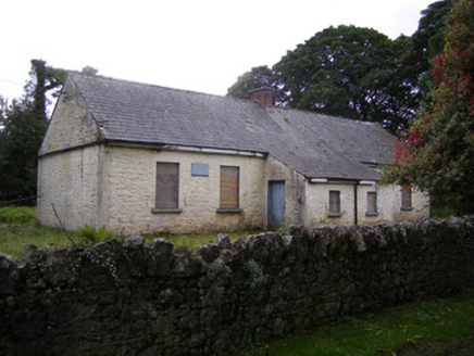 Nutgrove National SchoolSchool · 1.1 mi
Explorer Tom Nutgrove National School in Mullagh has two doors, which confuses the local sheep who just want to get in for a snack. The plaque says 1870, but it looks like it’s still waiting for recess to end. Stand on the spot and imagine you’re five years old and bored.
 Dysert Castle (in ruins)Castle, tower house · 3.8 mi
Explorer Tom Dysert Castle is looking particularly smug today. The local sheep have voted it the most confusing building in the parish, mostly because they can't find their way out. Tell your mates you found it first.
_-_geograph.org.uk_-_6276707.jpg/250px-Castles_of_Munster,_Dysert,_Limerick_(1)_-_geograph.org.uk_-_6276707.jpg "Photo: Mike Searle, Wikimedia Commons · CC BY-SA 2.0") Dysert CastleCastle · 3.8 mi
Dysert CastleCastle · 3.8 miMore archaeology and monuments in County Limerick · All of County Limerick

What do you know about this place?Tap to add a comment or ask a question