What is recorded here
According to Kate Taylor (04E0971) 'an excavation was carried out following the discovery of a curvilinear ditch during monitoring of topsoil-stripping for a single-house development. The ditch was fully excavated within the development area and was shown to have been severely truncated by ploughing in recent years, leaving a shallow feature that produced no artefactual evidence. The ditch was 28m long, 0.65-0.98m wide and 0.06-0.18m deep, with a gently concave profile. The feature was deeper and wider at the southern end and petered out at the eastern end. Extrapolation of the curve of the ditch suggests an enclosure with a diameter of c. 20-25m. Although the ditch appears to be part of a subcircular enclosure, the remainder of which lies outside the development area, its date and function remain unclear. No internal or external features were revealed within the excavated area and no material suitable for dating was recovered.' This description is posted on the web at the following internet address (accessed 3 August 2012): http://www.excavations.ie/
Compiled by: Denis Power
Date of Upload: 3 August 2012
The monument record does not grant public access. Check the route and ask the landowner before entering private land.
- What survives
- Recorded monument
Places near here
 Annes Fort - IndicatedFairy fort / earthen ringfort · 121 yd
 Anne's FortArchaeological place · 129 yd
 post boxpost box · 675 yd
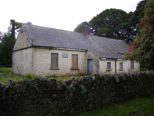 Nutgrove National Schoolschool · 895 yd
 CastleCastle, unclassified · 1.5 mi
 Lismakeery Castle (in ruins)Castle, tower house · 1.7 mi
 St. Kieran's WellSpring · 3.2 mi
 TobernablahySpring · 3.4 mi
 Askeaton CastleHeritage attraction · 3.5 mi
 Holly IslandIslet · 4.1 mi
 Foynes Flying Boat & Maritime MuseumMuseum · 5.1 mi
 Gammarel PointHeadland · 5.2 mi