
What is recorded here
From OpenStreetMap (© OpenStreetMap contributors) w666112323
Places near here
Picture notes
- Computer-made picture. It does not show this monument.
- National Inventory of Architectural Heritage
 Lissatotan- HachuredFairy fort / earthen ringfort · 8 ydComputer-made picture
Explorer Tom Lissatotan is secretly proud of its one potato that survived the levelling. It’s basically a flat circle in a field now, but it remembers when it had height. Bring a camera and your most suspicious face.
 Fairy fort / earthen ringfort in CooltominFairy fort / earthen ringfort · 241 ydComputer-made picture
Explorer Tom This ringfort’s least favourite visitor is definitely the wind, which blows leaves into its ditch every single day. It’s covered in nettles and mature trees that judge your posture. Have a sandwich here and call it a heritage lunch.
 Fairy fort / earthen ringfort in Lissatotan (shanid By.)Fairy fort / earthen ringfort · 381 ydComputer-made picture
Explorer Tom Fairy fort / earthen ringfort in Lissatotan used to be grand until they turned it into a tyre storage unit. Imagine winning the lottery and buying a pile of old rubber instead of a yacht. Count the crows, then count again.
 Lisard- HachuredFairy fort / earthen ringfort · 513 ydComputer-made picture
Explorer Tom Lisard is where two families argued over who owned the sunset, probably for decades. The bank gets higher on one side just to show off how dramatic things were back then. Grand place for a sulk or a snog, your call.
 IndicatedEnclosure · 584 ydComputer-made picture
 Enclosure in CooltominEnclosure · 891 ydComputer-made picture
Explorer Tom This enclosure got levelled by a road that clearly didn’t check its map first. It’s now just a ghost of an arc on a limestone hill. Tell me if the gossip I made up is true.
Fairy fort / earthen ringfort in ArdlamanFairy fort / earthen ringfort · 1167 ydComputer-made pictureExplorer Tom The postman always seems suspicious of this oval because it never signs for its deliveries. The earth dump hides the line like a shy secret kept from prying eyes. Tell the kids it's a castle. Close enough.
Fairy fort / stone ringfort in Creeves (shanid By.)Fairy fort / stone ringfort · 1353 ydComputer-made pictureExplorer Tom This stone fort in Creeves refuses to fall down because it's too stubborn about its vertical inner face. It incorporates itself into fences like it's part of the furniture. Bring the dog, it'll have opinions.
 Fairy fort / earthen ringfort in Gortroe (connello Lower By.)Fairy fort / earthen ringfort · 1364 ydComputer-made pictureFairy fort / earthen ringfort in RanahanFairy fort / earthen ringfort · 1452 ydComputer-made picture
Explorer Tom Fairy fort / earthen ringfort in Ranahan was once a home for a poet who fell into the ditch nearby and never recovered his dignity. Now it’s completely levelled, like it just gave up. Find the date carved somewhere and feel clever.
 Riddlestown ParkCountry house · 1.2 mi
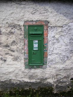 post box1.3 mi
More archaeology and monuments in County Limerick · All of County Limerick

What do you know about this place?Tap to add a comment or ask a question