
Places near here
Photo credits
- Intersport Elverys (image publisher); photographer not named, www.elverys.ie
- National Inventory of Architectural Heritage
- P L Chadwick, Geograph · Creative Commons Attribution-ShareAlike 2.0
- Graham Horn, Geograph · CC BY-SA 2.0
- Mike Searle, Geograph · CC BY-SA 2.0
 Carrig/Riverstown GAA pitchGAA ground · 185 yd
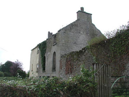 Carrig HouseMiller's house · 601 yd
Explorer Tom Carrig House is bragging about surviving a storm that probably only lasted ten minutes. The round-headed windows are…
 Catholic Church of the AnnunciationChurch/chapel · 745 yd
Explorer Tom Catholic Church of the Annunciation is standing strong on the road with that gable front that says 'I mean business'…
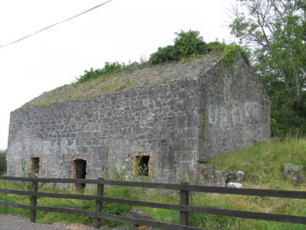 kiln771 yd
Explorer Tom Kiln in Ballykinash was allegedly used to smuggle contraband pies through the chimney, which no one believes but…
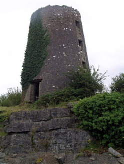 mill (wind)816 yd
Explorer Tom Mill in Ballykinash is planning its retirement by pretending to be a very fancy birdhouse. The walls are solid, but the…
 Clohaskin Castle (in Ruins)Castle, hall-house · 1102 yd
Explorer Tom Clohaskin Castle hosted a dance that went so far that the walls still haven't fully recovered from the shock. It’s a…
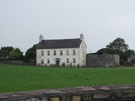 Ivy HallHouse · 1333 yd
Explorer Tom Ivy Hall in Loughkeen is telling a ridiculous smuggling story about contraband ivy that was smuggled in right next to…
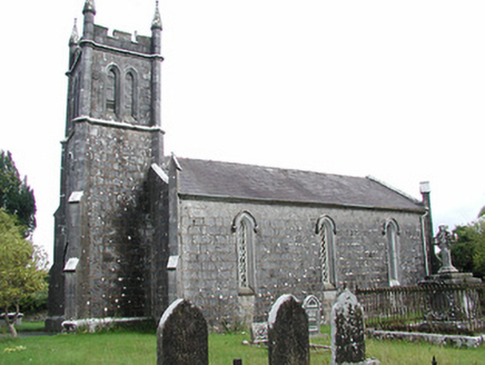 Loughkeen ChurchChurch/chapel · 1401 yd
Explorer Tom Loughkeen Church in County Tipperary sits on a spot older than dirt and bad decisions. There is an ancient curse here…
 Loughkeen HouseRectory/glebe/vicarage/curate's house · 1588 yd
Explorer Tom Loughkeen House in Loughkeen remembers the poet who fell in the ditch nearby and still won't forgive him for the mess.…
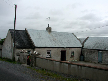 farm house2.2 mi
Explorer Tom Farm house in Ballinamoe witnessed a love story go wrong right next door, probably involving a cow and a…
 Baronne CourtFarmyard complex · 2.2 mi
Explorer Tom Baronne Court in Stonestown had a bad poem written about it once: 'Oh stone, so round, oh wall, so brown.' It’s the…
 KIllaleigh CastleBawn · 5.1 mi
Explorer Tom Killaleigh Castle would bring a Z-plan diagram and a stiff upper lip to any party. It’s four storeys high but feels…
More archaeology and monuments in County Tipperary · All of County Tipperary

What do you know about this place?Tap to add a comment or ask a question