DDiscover AloneMapAbout

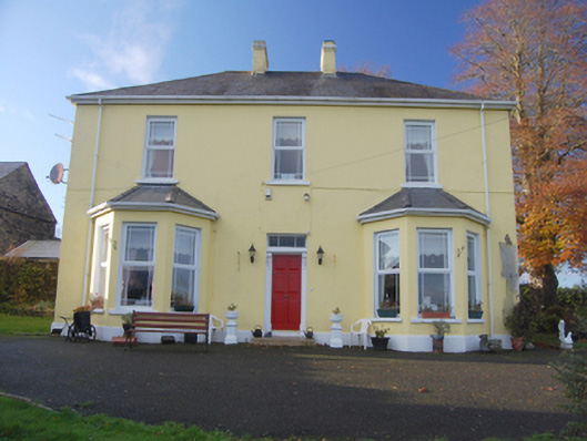
House in Moneen

House
House in Moneen
Photo: National Inventory of Architectural Heritage · Report the wrong picture

This does not grant access. Most recorded buildings are privately owned; view them only from public ground unless the owner allows entry.

What do you know about this place?Tap to add a comment or ask a question

What you write will be public.

What is recorded here

Detached three-bay two-storey house, built c. 1890, having single-storey canted bay windows to either side of central doorway to the main elevation (east), and with single-storey block or earlier house to rear, built c. 1800. Hipped slate roof with projecting eaves course, and a central pair of rendered chimneystacks…

Read the whole record
Detached three-bay two-storey house, built c. 1890, having single-storey canted bay windows to either side of central doorway to the main elevation (east), and with single-storey block or earlier house to rear, built c. 1800. Hipped slate roof with projecting eaves course, and a central pair of rendered chimneystacks with moulded smooth rendered cornice course. Hipped slate roofs to canted bays. Smooth rendered ruled-and-lined walls over projecting smooth rendered plinth. Square-headed window openings with painted stone sills, and having replacement windows with margin glazing effect. Central square-headed doorway with replacement timber panelled door, flanking timber pilasters with decorative timber consoles over, moulded timber lintel, and with overlight. Attached block or earlier house to rear, built c. 1800, having pitched corrugated-sheeted roof with rendered chimneystack and some surviving sections of cast-iron rainwater goods, roughcast rendered walls, and square-headed window openings with replacement fittings; extension to the south side of earlier block\house having pitched slate roof, rubble stone walls, and square-headed window openings with replacement fittings. Set back from road in own grounds in the rural countryside to the north-east of Ballindrait. Formal garden to the east. Garden to the east and south-east enclosed by rubble stone boundary wall with rubble stone solider coping over. Gateway to the north comprising a pair of roughcast rendered gate piers (on square-plan) having a pair of wrought-iron flat bar gates. Gateway flanked to either side by curved quadrant sections of roughcast rendered boundary walls. Detached four-bay two-storey outbuilding to the south having external flight of rubble stone steps to the west elevation having access to doorway at first floor level, pitched natural purple slate roof, coursed rubble stone walls with dressed ashlar block-and-start quoins to corners, date stone to south elevation reading ‘John Macbeth A.D. 1860’, square-headed openings with red brick reveals at first floor level. Two-storey outbuilding to the south-west, arranged parallel with dated outbuilding, having pitched natural slate roof, rubble stone walls, and square-headed window and door openings. Modern outbuildings and farm buildings to site.
Despite some modern alterations, this well-proportioned house, dating to the end of the nineteenth century, retains much of its early form and character. Its visual appeal is enhanced by the retention of the slate roof while the doorway with flanking pilasters with delicately-carved timber console brackets provides an attractive central focus. The loss of the original fittings to the openings detracts from its appeal but suitable modern replacements could easily be installed. The canted bays are a characteristic feature of many houses of its type and date and give this otherwise plain building a strong presence in the rural landscape to the north-east of Ballindrait. This house appears to incorporate an earlier single-storey vernacular house to the rear, which provides an interesting historical insight into the development of this apparently prosperous farmstead during the nineteenth century. The two substantial two-storey outbuildings to the south add significantly to setting and context. These outbuildings survive in good condition and are robustly built using local rubble stone masonry. The cut stone quoins and the stone date plaque to one of the outbuildings add some additional interest. The date stone is of some social interest, providing some information on the builder (John Macbeth) of the building, and presumably the owner of the farm, when it was constructed. This building was the residence of the MacBeth family by 1834 (death record) and was later in the ownership of Joseph MacBeth in 1894 (Slater’s Directory). It was still in the ownership of Joseph MacBeth in 1911 (Census). This building makes a positive contribution to the rural landscape, and is an element of the built heritage of the local area. The simple gateway to the north adds to the setting and context, and completes this interesting composition.

From the Buildings of Ireland (National Inventory of Architectural Heritage) record 40907004

Places near here

Photo credits
  • National Inventory of Architectural Heritage
  • Kenneth Allen, Geograph · Creative Commons Attribution-ShareAlike 2.0
  • Maker not stated on source page, en.wikipedia.org
  • Maker not stated on source page, www.pinterest.com
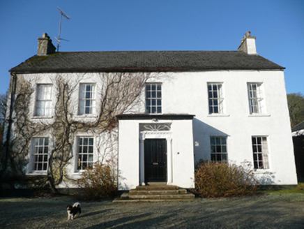
Cavanacor HouseCountry house · 584 yd

Explorer Tom Cavanacor House is flashing its timber sash windows from 1823 and a porch that reuses an older doorcase with Tuscan…
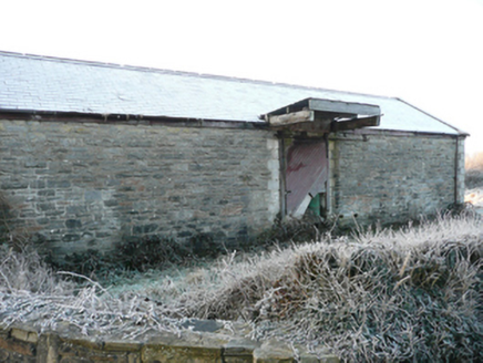
goods shed835 yd

Explorer Tom Goods shed in Ballindrait was built for a three-foot-gauge railway, which is barely wider than me. I bet the train…

Ballindrait Presbyterian ChurchChurch/chapel · 1129 yd

Explorer Tom Ballindrait Presbyterian Church was ranked as 'second class' back in 1837, which sounds like a really mean teacher's…
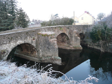
Ballindrait BridgeBridge · 1278 yd

Explorer Tom Ballindrait Bridge is a triple-arch beauty that would tell its younger self to stop trying so hard with the rubble…

outbuilding1290 yd

Explorer Tom The Outbuilding in Murlough would absolutely crush you in a job interview by bragging about its robust rubble stone…

Standing stone in RossgeirStanding stone · 1332 yd

Explorer Tom Standing stone in Rossgeir has vanished completely, leaving just an empty patch of good land! It’s like it packed its…
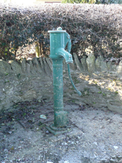
water pump1379 yd

Explorer Tom Water pump in Millseesiagh thinks the road leading to it is too rough for its delicate cast-iron handle, which is a bit…

GuystownHouse · 1431 yd

Explorer Tom Guystown ended up in the wrong place because the builder got distracted by a shiny rock and kept building further…
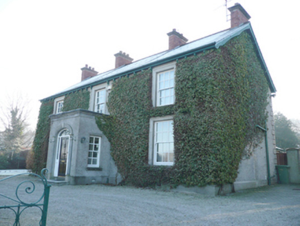
Ballindrait Presbyterian ManseManse · 1533 yd

Explorer Tom Ballindrait Presbyterian Manse in Murlough is pretending to be a celebrity’s secret hideaway. Rumor has it a famous…

Standing stone in Murlough (clonleigh South Ed)Standing stone · 1625 yd

Explorer Tom Standing stone in Murlough is just gone! The map says it was on a hillside that slopes north and west, but now there’s…
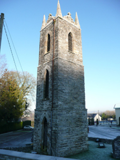
St. Patrick’s Catholic ChurchChurch/chapel · 1640 yd

Explorer Tom St. Patrick’s Catholic Church is just a big stone head with no body! The church got demolished in 1965, but this tower…
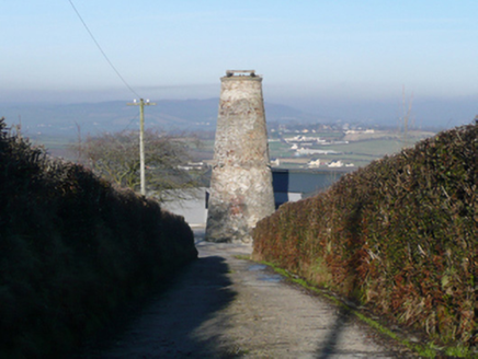
Ballindrait WindmillMill (wind) · 1.1 mi

Explorer Tom The Ballindrait Windmill is sitting on top of Croaghan Hill dominating the landscape like it owns the place, which I…

More historic places in County Donegal · All of County Donegal

Add to this placeAdd a picture Add a detailed tip Add a story

Explore the map1,095,414 places to discover

Next place · or swipeCavanacor House