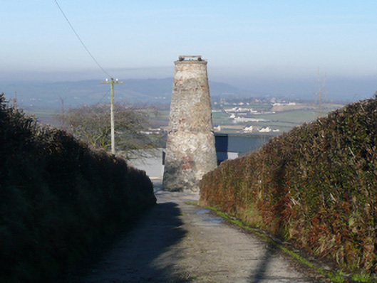
What is recorded here
Freestanding six-stage former windmill (on circular-plan), dated 1874(?), having walls tapering from base. Now ruinous (unused since 1932). Ashlar coping over tower having remains of timber rotating sail mechanism over. Rubble stone walls with remnants of lime render over. Cut stone date plaque (on diamond-plan) to…
Read the whole record
From the Buildings of Ireland (National Inventory of Architectural Heritage) record 40834005
Places near here
Photo credits
- National Inventory of Architectural Heritage
- Kenneth Allen, Geograph · CC BY-SA 2.0
- Mike Simms, Wikimedia Commons · CC BY-SA 2.0
- Kenneth Allen, Wikimedia Commons · CC BY-SA 2.0
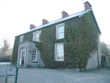 Ballindrait Presbyterian ManseManse · 574 yd
Explorer Tom Ballindrait Presbyterian Manse has four red brick chimneystacks with clay-ware pots, standing tall above its roughcast walls in the countryside.
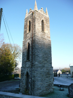 St. Patrick’s Catholic ChurchChurch/chapel · 585 yd
Explorer Tom St. Patrick’s Catholic Church is just a big stone head with no body! The church got demolished in 1965, but this tower stayed behind to keep ringing bells for nobody. I bet it gets really confused when people walk past Liam McCormick’s new building next door.
 McCauley's RestaurantRestaurant · 1.2 mi
Explorer Tom McCauley's Restaurant serves fish and chips that are likely swimming in batter. If the fish looks suspiciously like a rock, don't worry, it's probably just very well-seasoned stone from the Atlantic Ocean.
 Croaghan HillMountain / peak · 1.4 mi
Explorer Tom Croaghan Hill keeps a 21-metre-wide passage tomb right in the middle of an enclosure where some walls are barely visible. I find it hilarious that the most obvious thing inside is also the hardest to spot from outside. It’s like hiding the key under the doormat, but the doormat has vanished.
 Abercorn FactoryHeritage attraction · 1.9 mi
 Castle in Town Parks of StrabaneCastle · 2.0 mi
 Gray PrinterHeritage attraction · 2.0 mi
 Cloghfin Standing StonePublicly named standing stone · 2.9 mi
Explorer Tom Cloghfin Standing Stone sounds like a place where clouds go to take a nap. If you looked closely, I’d bet it’s actually just a very round rock pretending to be something much more mysterious.
 Magherareagh Standing StoneStanding stone · 3.3 mi
Explorer Tom Magherareagh Standing Stone is leaning so hard to the south-east it looks about to fall over! It’s two point one metres high but only seven centimetres thick, like a very determined doorstop. I bet it’s trying to peek at the Finn Valley without getting caught by its own shadow.
 McBride’s BarPub · 4.1 mi
Explorer Tom McBride’s Bar looks south towards Sandy Road, which sounds like a beach but feels like a trap. I bet the pints are served in thimbles. Cheers to you, you lucky devil!
 Carnowen HillMountain / peak · 4.1 mi
Explorer Tom From Carnowen Hill, you can gaze north-east across the rolling hills of County Donegal and take a deep breath.
 PalaceHouse, fortified house · 4.2 mi
Explorer Tom The Palace in Raphoe Demesne is a ghost with a very specific birth year of 1637. Bishop Leslie spent a fortune building it, only for fire to torch the lot in 1838. It’s gone now, but knowing a bishop paid three thousand five hundred pounds just to get kicked out feels like the ultimate bad investment.
More historic places in County Donegal · All of County Donegal

What do you know about this place?Tap to add a comment or ask a question