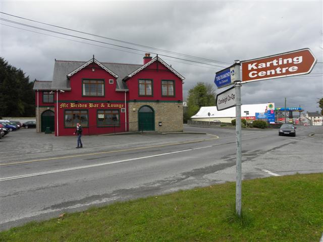
About this business
From OpenStreetMap (© OpenStreetMap contributors) way 1074351929
Places near here
Photo credits
- Kenneth Allen, Geograph · CC BY-SA 2.0
- National Inventory of Architectural Heritage
- Kenneth Allen, Wikimedia Commons · CC BY-SA 2.0
- Mike Simms, Wikimedia Commons · CC BY-SA 2.0
 Castlefinn Catholic ChurchChurch/chapel · 100 yd
Explorer Tom Castlefinn Catholic Church rises in height from west to east with staggered step-like walls, featuring a cross finial on its pyramidal pantile roof.
 OutlinedBawn · 135 yd
Explorer Tom Bawn in Castlefinn is the ghost of Sir John Kingsmill's impressive 1618 fort, which he called a very strong stone house with good lodgings. It’s a bit tricky to spot now because St. Mary’s Church sits directly on its footprint, but imagine that square bawn holding up a whole village in the seventeenth century.
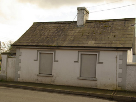 gate lodge, sexton's house182 yd
Explorer Tom Gate lodge, Sexton's house in Castlefinn was both a church gate lodge and a sexton's house, built around 1878. Its little side porch had a lot of jobs for such a tiny building. I think it deserves a second front door just to fit both titles.
 Magherareagh Standing StoneStanding stone · 1.2 mi
Explorer Tom Magherareagh Standing Stone is leaning so hard to the south-east it looks about to fall over! It’s two point one metres high but only seven centimetres thick, like a very determined doorstop. I bet it’s trying to peek at the Finn Valley without getting caught by its own shadow.
 Dooghan / Carnowen Standing StoneStanding stone · 1.7 mi
Explorer Tom Dooghan / Carnowen Standing Stone is a whopping 1.88m tall, which means it’s basically as big as me! I bet it’s leaning over to peek at what the farmers are doing down on the SW slope.
 Carnowen HillMountain / peak · 1.8 mi
Explorer Tom From Carnowen Hill, you can gaze north-east across the rolling hills of County Donegal and take a deep breath.
Battle site: in 789 AD & battle of the fords , Southern crossing, 1689 in Clady; DonnygowanBattle site: in 789 AD & battle of the fords , Southern crossing, 1689 · 2.0 mi Croaghan HillMountain / peak · 2.7 mi
Explorer Tom Croaghan Hill keeps a 21-metre-wide passage tomb right in the middle of an enclosure where some walls are barely visible. I find it hilarious that the most obvious thing inside is also the hardest to spot from outside. It’s like hiding the key under the doormat, but the doormat has vanished.
 McCauley's RestaurantRestaurant · 4.8 mi
Explorer Tom McCauley's Restaurant serves fish and chips that are likely swimming in batter. If the fish looks suspiciously like a rock, don't worry, it's probably just very well-seasoned stone from the Atlantic Ocean.
Battle site: battle of the fords, Central crossing, 1689 in Magirr; Town Parks of StrabaneBattle site: battle of the fords, Central crossing, 1689 · 4.8 mi PalaceHouse, fortified house · 4.8 mi
Explorer Tom The Palace in Raphoe Demesne is a ghost with a very specific birth year of 1637. Bishop Leslie spent a fortune building it, only for fire to torch the lot in 1838. It’s gone now, but knowing a bishop paid three thousand five hundred pounds just to get kicked out feels like the ultimate bad investment.
 Diamond BarPub · 4.9 mi
Explorer Tom Diamond Bar in Raphoe is sparkling like a gem that forgot to shower. Pop in for a pint before it realizes how smelly it actually is.
What do you know about this place?Tap to add a comment or ask a question