What is recorded here
Castlefinn (site of) (DG079-023001-): This O'Donnell castle undoubtedly served to guard a ford on the River Finn. Nial Garbh O'Donnell resided here in 1601 (CSPI 1600-1, 278). In 1622, it was described as 're-edified with good additions to it by Sir John Kingsmill' and had a strong bawn (DG079-023002-) adjoining it (Treadwell 1953-5, 516). It had fallen to ruins by 1654-6 (Simmington 1937, 23). In 1618/19 Nicholas Pynnar described the home of Sir John Kingsmill as 'a Bawne of Lime and Stone 100 feet [30.4m] square, with two Flankers, the which are two stories high, with good Lodgings in them, and a very strong stone House three stories high; himself with his Wife and Family dwelling therein. Near to the Bawne is built a Village' (Hill 1877, 518). According to local tradition this 17th century bawn known locally as Kingsmill Bawn was not built on the site of the medieval O'Donnell castle (DG079-023001-) but was located in the centre of the 17th century village of Castlefinn. The modern R.C church dedicated to St. Mary now occupies the site of the 17th century bawn. Kingsmill's bawn was built on the site of the old Manor house where Captain Butler once lived and is now where the New Roman Catholic Church St. Mary's stands. This site was previously owned by Captain Butler and his family home was demolished in the mid 1960's (Knox 2003, 31). The above description was derived from the 'Archaeological Survey of County Donegal. A description of the field antiquities of the County from the Mesolithic Period to the 17th century.' Compiled by: Brian Lacey with Eamon Cody, Claire Cotter, Judy Cuppage, Noel Dunne, Vincent Hurley, Celie O'Rahilly, Paul Walsh and Seán Ó Nualláin (Lifford: Donegal County Council, 1983).
Castlefinn (site of) (DG079-023001-): This O'Donnell castle undoubtedly served to guard a ford on the River Finn. Nial Garbh O'Donnell resided here in 1601 (CSPI 1600-1, 278). In 1622, it was described as 're-edified with good additions to it by Sir John Kingsmill' and had a strong bawn (DG079-023002-) adjoining it (Treadwell 1953-5, 516). It had fallen to ruins by 1654-6 (Simmington 1937, 23). In 1618/19…
From the National Monuments Service (Archaeological Survey of Ireland) record DG079-023002
The monument record does not grant public access. Check the route and ask the landowner before entering private land.
- What survives
- Recorded monument
Places near here
 Castlefinn Catholic ChurchChurch/chapel · 36 yd
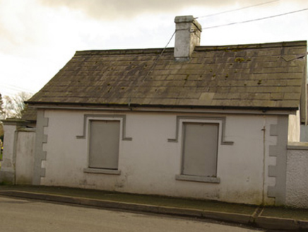 gate lodge, sexton's house164 yd
 Magherareagh Standing StoneStanding stone · 1.2 mi
 Dooghan / Carnowen Standing StoneStanding stone · 1.8 mi
 Carnowen HillMountain / peak · 1.8 mi
 Croaghan HillMountain / peak · 2.6 mi
 PalaceHouse, fortified house · 4.9 mi
 Castle in Town Parks of StrabaneCastle · 5.2 mi
 Battle of ScarrifholisBattle · 12 mi
 Newmills Corn and Flax MillsHeritage attraction · 12 mi
 European Yew13 mi
 Rowan13 mi
Pictures: Kenneth Allen, Geograph · CC BY-SA 2.0; National Inventory of Architectural Heritage; Kenneth Allen, Wikimedia Commons · CC BY-SA 2.0; Mike Simms, Wikimedia Commons · CC BY-SA 2.0; Me, Wikimedia Commons · Public domain; Dr Neil Clifton, Geograph · CC BY-SA 2.0; Sitomon, Wikimedia Commons · CC BY-SA 2.0; Eeno11, Wikimedia Commons · CC BY-SA 3.0
More castles and forts in County Donegal · All of County Donegal
What do you know about this place?