DDiscover AloneMapAbout

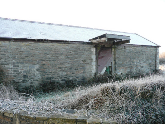
Goods shed in Ballindrait

Goods shed
Goods shed in Ballindrait
Photo: National Inventory of Architectural Heritage · Report the wrong picture

This does not grant access. Most recorded buildings are privately owned; view them only from public ground unless the owner allows entry.

What do you know about this place?Tap to add a comment or ask a question

What you write will be public.

What is recorded here

Detached double-height former railway goods shed associated with the former Ballindrait railway station (demolished), built c. 1909, having projecting cantilevered canopy over loading bay to the north end. Now out of use, in use as outbuilding with modern house adjacent to the east. Pitched natural slate roof with…

Read the whole record
Detached double-height former railway goods shed associated with the former Ballindrait railway station (demolished), built c. 1909, having projecting cantilevered canopy over loading bay to the north end. Now out of use, in use as outbuilding with modern house adjacent to the east. Pitched natural slate roof with terracotta ridge tiles, timber fascia to eaves and remains of cast-iron rainwater goods. Corrugated-metal roof to overhanging canopy to north. Squared and mildly rock-faced rubble stone walls with cement rendered block-and-start quoins to the corners. Round-headed window openings to the gable apexes to the west and east gable ends having rusticated cement rendered surrounds, concrete sills, and remains of metal radial windows. Square-headed loading bays to the centre of the north and south elevations having rusticated cement rendered block-and-start surrounds, and battened timber sliding doors with metal railed sliding mechanism. Set back from road in own grounds to the east of Ballindrait and adjacent to the north of the former Strabane and Letterkenny railway line. Former railway stationmaster’s house (see 40834011) and site of former railway station to the east, ancillary railway structure to the west.
This simple but well-built former railway goods shed was originally built to serve the former Ballindrait railway station (now demolished). It retains its early form and character despite being out of use for a considerable period. It is robustly built in local rubble stone masonry, and its survival in relatively good condition is testament to the quality of its original construction. Its visual expression is enhanced by the retention of the natural slate roof, battened timber sliding doors to the loading bays, while a number of the original metal-framed windows survive to the gable ends. The block-and-start quoins to the corners and to the openings, the block-and-start surrounds to the openings help to give this utilitarian structure a strong architectural character that is indicative of the long-term ambitions of the various railway companies operating in Ireland during the late-nineteenth and into the first decades of the twentieth century. This structure was originally built as a railway goods shed associated with the former Ballindrait railway station, and its relatively large scale provides an interesting historical insight into the level of freight passing along this line during its heyday. This former railway goods shed was originally constructed by the Strabane to Letterkenny Railway Company (worked by the Donegal Railway Company Joint Committee) as part of the Strabane to Letterkenny narrow gauge railway line (three foot gauge), which opened in January 1909 and closed on the 1st of January 1960. This was the final railway line built in Donegal and formed part of an extensive network of railway lines and narrow gauge railway lines that served the county up until the mid-twentieth century. This unassuming structure now acts as an interesting historical reminder of this former extensive railway network, and is an integral element of the built heritage of the local area and of the wider transport heritage of the county. It forms part of a group of railway structures at Ballindrait along with the former stationmaster’s house (see 40834011) to the east, ancillary structures to the west, and a former crossing guard’s house (see 40834014) to the north-west.

From the Buildings of Ireland (National Inventory of Architectural Heritage) record 40834017

Places near here

Photo credits
  • Kenneth Allen, Geograph · Creative Commons Attribution-ShareAlike 2.0
  • National Inventory of Architectural Heritage
  • Maker not stated on source page, www.pinterest.com
  • Maker not stated on source page, en.wikipedia.org
  • Mike Simms, Wikimedia Commons · CC BY-SA 2.0
Ballindrait Presbyterian ChurchChurch/chapel · 399 yd

Explorer Tom Ballindrait Presbyterian Church was ranked as 'second class' back in 1837, which sounds like a really mean teacher's…
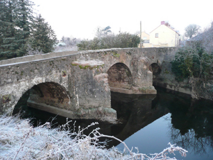
Ballindrait BridgeBridge · 510 yd

Explorer Tom Ballindrait Bridge is a triple-arch beauty that would tell its younger self to stop trying so hard with the rubble…
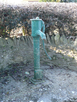
water pump567 yd

Explorer Tom Water pump in Millseesiagh thinks the road leading to it is too rough for its delicate cast-iron handle, which is a bit…
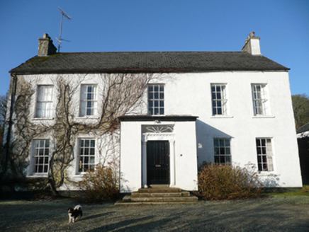
Cavanacor HouseCountry house · 597 yd

Explorer Tom Cavanacor House is flashing its timber sash windows from 1823 and a porch that reuses an older doorcase with Tuscan…

outbuilding770 yd

Explorer Tom The Outbuilding in Murlough would absolutely crush you in a job interview by bragging about its robust rubble stone…

GuystownHouse · 1144 yd

Explorer Tom Guystown ended up in the wrong place because the builder got distracted by a shiny rock and kept building further…

Standing stone in Murlough (clonleigh South Ed)Standing stone · 1162 yd

Explorer Tom Standing stone in Murlough is just gone! The map says it was on a hillside that slopes north and west, but now there’s…
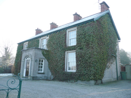
Ballindrait Presbyterian ManseManse · 1225 yd

Explorer Tom Ballindrait Presbyterian Manse in Murlough is pretending to be a celebrity’s secret hideaway. Rumor has it a famous…
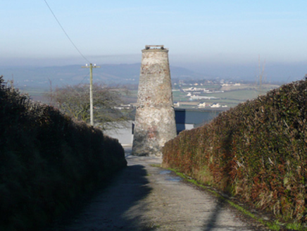
Ballindrait WindmillMill (wind) · 1318 yd

Explorer Tom The Ballindrait Windmill is sitting on top of Croaghan Hill dominating the landscape like it owns the place, which I…
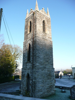
St. Patrick’s Catholic ChurchChurch/chapel · 1344 yd

Explorer Tom St. Patrick’s Catholic Church is just a big stone head with no body! The church got demolished in 1965, but this tower…

Standing stone in RossgeirStanding stone · 1486 yd

Explorer Tom Standing stone in Rossgeir has vanished completely, leaving just an empty patch of good land! It’s like it packed its…

Croaghan HillMountain / peak · 1.7 mi

Explorer Tom Croaghan Hill keeps a 21-metre-wide passage tomb right in the middle of an enclosure where some walls are barely…

More historic places in County Donegal · All of County Donegal

Add to this placeAdd a picture Add a detailed tip Add a story

Explore the map1,095,414 places to discover

Next place · or swipeBallindrait Presbyterian Church