What is recorded here
From the National Monuments Service (Archaeological Survey of Ireland) record LH021-007
Places near here
Photo credits
- National Inventory of Architectural Heritage
- Kieran Campbell, Geograph · CC BY-SA 2.0
- Maker not stated on source page, en.wikipedia.org
- Maker not stated on source page, www.flickr.com
- Maker not stated on source page, www.pinterest.com
- Willard Rome, Geograph · CC BY-SA 2.0
- Colin Park, Geograph · CC BY-SA 2.0
- Kevin King, Wikimedia Commons · CC BY 2.0
- Adriao, Wikimedia Commons · CC BY-SA 4.0
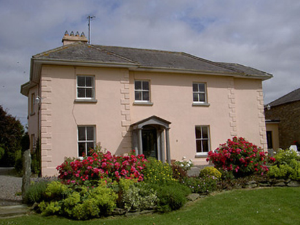 presbytery/parochial/curate's house388 yd
Explorer Tom Presbytery in Tinure holds a fake world record for having the most serious little Doric portico on record. It’s all…
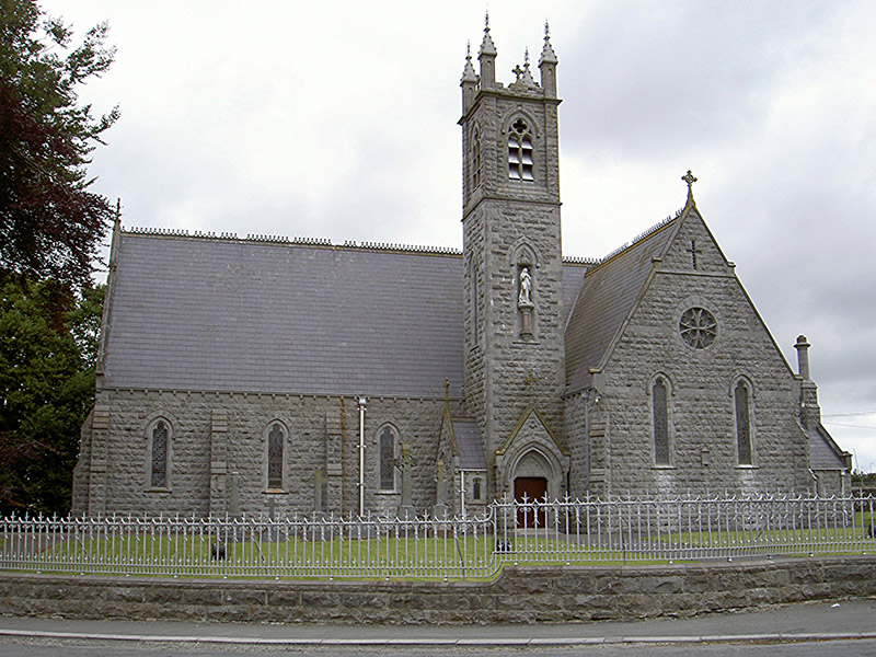 Catholic Church of Our Lady of the Immaculate ConceptionChurch/chapel · 428 yd
Explorer Tom Church in Tinure claims 'Immaculate Conception' just means nobody ever messes up the parking lot, which is a stretch…
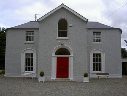 Mullary HouseHouse · 1672 yd
Explorer Tom Mullary House in Castletown is dressed up too nice to be bothered by your nosing around. Its windows are judging your…
 Church (in Ruins)Church · 1705 yd
Explorer Tom Church in Castletown is 1818 but wearing stones from an older coat to look tough. Someone wrote a bad poem about it…
 Earthwork in RathdanielEarthwork · 1746 yd
Explorer Tom Earthwork in Rathdaniel is a fort called Lios Rat Dineail that refuses to show up when you’re looking for it. It…
 Fairy fort / earthen ringfort in RathdanielFairy fort / earthen ringfort · 1.0 mi
Explorer Tom Fairy fort / earthen ringfort in Rathdaniel used to employ a matchmaker who paired off anyone wandering into its wide…
 CastleCastle, motte and bailey · 1.1 mi
Explorer Tom Priest Town Castle has a legend about a giant who lost his trousers in the fosse, which explains the smell. It’s been…
 Stone CrossesCross, High cross · 1.1 mi
Explorer Tom North cross at Monasterboice wants its tombstone to say 'Sorry about the shaft situation'. It’s been re-erected on a…
 Round Tower1.1 mi
Explorer Tom Monasterboice round tower lost a bet with a priest who claimed he could climb it in his slippers. It’s still standing…
 Monasterboice Round TowerHeritage attraction · 1.1 mi
Explorer Tom Monasterboice Round Tower has decided its New Year's resolution is to stop being so tall and start being more…
 Monasterboice AbbeyRuins · 1.1 mi
Explorer Tom You came to Monasterboice for one high cross? Louth has laid out three and a round tower to keep you busy. Saint Buithe…
 Muiredach's High CrossHeritage attraction · 1.1 mi
Explorer Tom You think I can read every carving on Muiredach's Cross? Pull up a chair. Muiredach's High Cross at Monasterboice is a…
More archaeology and monuments in County Louth · All of County Louth

What do you know about this place?Tap to add a comment or ask a question