
What is recorded here
From the National Monuments Service (Archaeological Survey of Ireland) record LH020-021
Places near here
Photo credits
- Maker not stated on source page, www.flickr.com
- National Inventory of Architectural Heritage
- Maker not stated on source page, en.wikipedia.org
- Willard Rome, Geograph · CC BY-SA 2.0
- Colin Park, Geograph · CC BY-SA 2.0
- Maker not stated on source page, www.pinterest.com
- Adriao, Wikimedia Commons · CC BY-SA 4.0
- Kevin King, Wikimedia Commons · CC BY 2.0
- Maker not stated on source page, uk.pinterest.com
- Andreas F. Borchert, Wikimedia Commons · CC BY-SA 4.0
- Algirdas at Lithuanian Wikipedia, Wikimedia Commons · Public domain
 Fairy fort / earthen ringfort in RathdanielFairy fort / earthen ringfort · 614 yd
Explorer Tom Fairy fort / earthen ringfort in Rathdaniel used to employ a matchmaker who paired off anyone wandering into its wide…
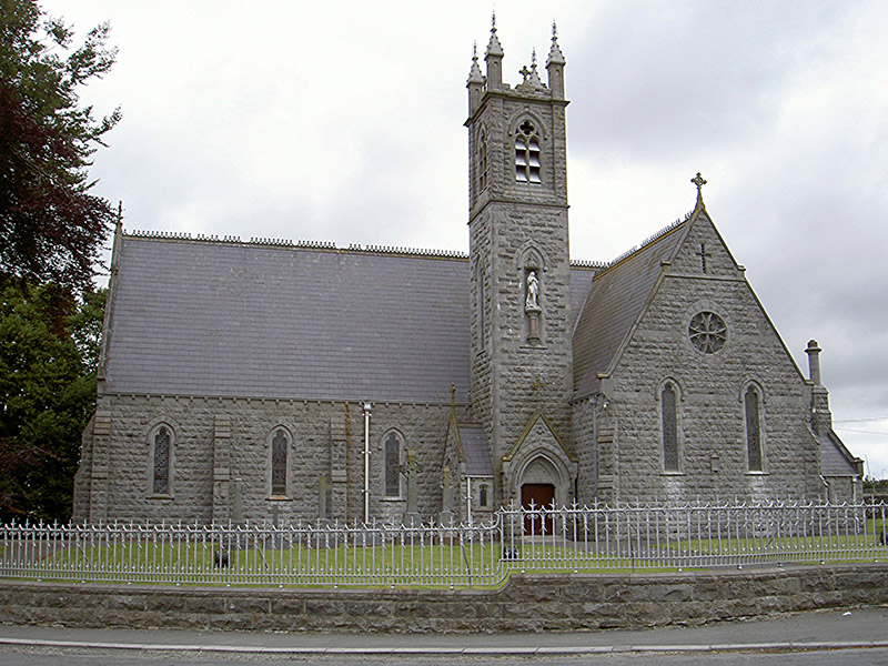 Catholic Church of Our Lady of the Immaculate ConceptionChurch/chapel · 1492 yd
Explorer Tom Church in Tinure claims 'Immaculate Conception' just means nobody ever messes up the parking lot, which is a stretch…
 Earthwork in GunstownEarthwork · 1.1 mi
Explorer Tom Earthwork in Gunstown is defaced because the wind keeps picking on its poor old banks and making fun of them. It’s no…
 Round Tower1.2 mi
Explorer Tom Monasterboice round tower lost a bet with a priest who claimed he could climb it in his slippers. It’s still standing…
 Monasterboice Round TowerHeritage attraction · 1.2 mi
Explorer Tom Monasterboice Round Tower has decided its New Year's resolution is to stop being so tall and start being more…
 Stone CrossesCross, High cross · 1.3 mi
Explorer Tom West cross at Monasterboice swears King Henry came to visit and promised to fix the roof, but nobody believes him. It’s…
 Muiredach's High CrossHeritage attraction · 1.3 mi
Explorer Tom You think I can read every carving on Muiredach's Cross? Pull up a chair. Muiredach's High Cross at Monasterboice is a…
 Monasterboice AbbeyRuins · 1.3 mi
Explorer Tom You came to Monasterboice for one high cross? Louth has laid out three and a round tower to keep you busy. Saint Buithe…
 Bullaun stone in MonasterboiceBullaun stone · 1.3 mi
Explorer Tom Bullaun stone in Monasterboice is actually a broken quern that got promoted to holy status because nobody checked the…
 MonasterboiceEarly monastic site · 1.3 mi
Explorer Tom Monasterboice in County Louth is run by a dog that barks at monks, deciding who gets to sit where. Pretend you're a…
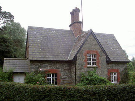 Monasterboice HouseGate lodge · 1.5 mi
Explorer Tom Monasterboice House gate lodge in Cordoogan swears there’s a hidden tunnel straight to the pub, but nobody believes him…
 Pedunculate Oak2.3 mi
Explorer Tom Pedunculate Oak in County Meath has very strong opinions on modern buildings and thinks they’re all just cardboard…
More archaeology and monuments in County Louth · All of County Louth

What do you know about this place?Tap to add a comment or ask a question