
What is recorded here
From the National Monuments Service (Archaeological Survey of Ireland) record LH021-062006
The monument record does not grant public access. Check the route and ask the landowner before entering private land.
- What survives
- Recorded monument
Places near here
 Monasterboice Round TowerHeritage attraction · 2 yd
 Muiredach's High CrossHeritage attraction · 15 yd
 Monasterboice AbbeyRuins · 23 yd
 Stone CrossesCross, High cross · 49 yd
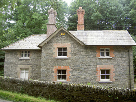 Monasterboice HouseGate lodge · 1417 ydBarabonaMountain / peak · 1474 yd
 ToberanelshyHoly well · 2.5 mi
 Pedunculate Oak2.6 mi
 European ash3.1 mi
 Battle of the Boyne Visitor CentreMuseum · 3.8 mi
_tussen_Jacobus_II_en_Willem_III,_12_juli_1690_Rijksmuseum_SK-A-605.jpeg/250px-De_slag_aan_de_Boyne_(Ierland)_tussen_Jacobus_II_en_Willem_III,_12_juli_1690_Rijksmuseum_SK-A-605.jpeg "Photo: Jan van Huchtenburgh, Wikimedia Commons · Public domain") Battle of the BoyneMajor battlefield · 3.8 mi
Battle of the BoyneMajor battlefield · 3.8 mi IndicatedCastle, tower house · 6.1 mi
Pictures: Colin Park, Geograph · CC BY-SA 2.0; Adriao, Wikimedia Commons · CC BY-SA 4.0; Kevin King, Wikimedia Commons · CC BY 2.0; Lior Kogan, Wikimedia Commons · CC BY-SA 4.0; National Inventory of Architectural Heritage; Kieran Campbell, Geograph · Creative Commons Attribution-ShareAlike 2.0; Algirdas at Lithuanian Wikipedia, Wikimedia Commons · Public domain; Willow, Wikimedia Commons · CC BY 2.5; Jan van Huchtenburgh, Wikimedia Commons · Public domain; Garry Dickinson, Geograph · CC BY-SA 2.0
More archaeology and monuments in County Louth · All of County Louth
What do you know about this place?