What is recorded here
From the National Monuments Service (Archaeological Survey of Ireland) record LI052-008
Places near here
Photo credits
- National Inventory of Architectural Heritage
- Maker not stated on source page, commons.wikimedia.org
- Maker not stated on source page, www.flickr.com
- Jonathan Thacker, Geograph · CC BY-SA 2.0
- Maker not stated on source page, www.pinterest.com
- Maker not stated on source page, irisharchaeology.org
- Maker not stated on source page, uk.pinterest.com
- Maker not stated on source page, se.pinterest.com
- Maker not stated on source page, www.youtube.com
- Maker not stated on source page, nl.pinterest.com
 bridge2.2 mi
Explorer Tom The Mountcollins bridge would tell you it’s the most experienced candidate for any job interview. It’s an arch that has…
 Church in ToornafullaChurch · 2.3 mi
Explorer Tom The Church in Toornafulla is basically invisible, which makes it perfect for the rabbits who live there. They think…
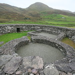 Enclosure in Brosna EastEnclosure · 2.4 mi
Explorer Tom Enclosure in Brosna East would survive a zombie attack by simply standing still and hoping they walk right through it.…
 Three CountiesPicnic place · 2.5 mi
Explorer Tom Three Counties in County Cork is a picnic spot right on the border of Limerick and Kerry, so you can eat a sandwich…
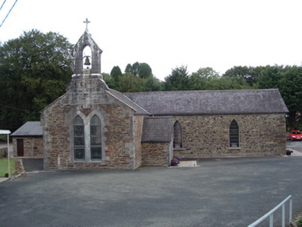 Saint Peter's ChurchChurch/chapel · 3.2 mi
Explorer Tom Saint Peter's Church in Tooreennagrena is dressed to the nines with limestone ashlar and stained glass. Built around…
 Standing stone in Tooreennagrena (bear By.)Standing stone · 4.0 mi
Explorer Tom Standing stone in Tooreennagrena is officially gone, which means you're looking at its ghost or a very convincing pile…
 Church in CloghvoulaChurch · 4.3 mi
Explorer Tom Church in Cloghvoula is playing hard to get, hiding behind stepping stones and zero visible trace. I reckon it took…
 Standing stone in TooreenclassaghStanding stone · 12 mi
Explorer Tom Standing stone in Tooreenclassagh used to be part of a trio until two got bored and left. Now it's just here, looking…
 Stone row in Ummeraboy WestStone row · 13 mi
Explorer Tom Stone row in Ummeraboy West, County Cork used to be three stones in a line, but they’ve all been removed now. Bowman…
 Cupmarked stone (present location) in Ummeraboy WestCupmarked stone (present location) · 14 mi
Explorer Tom Cupmarked stone in Ummeraboy West, County Cork was dumped against a fence after being moved around in the 80s. Locals…
 Standing stone in Knockeenadallane (duhallow By., Kilmeen Par.)Standing stone · 14 mi
Explorer Tom Standing stone in Knockeenadallane was originally over seven feet high, but now it’s just a stub. Someone broke off the…
 Standing stone in Park (duhallow By., Nohavaldaly Par.)Standing stone · 14 mi
Explorer Tom Standing stone in Park, County Cork used to be part of a pair called 'dallans', but both were removed in the late 1970s…
More archaeology and monuments in County Limerick · All of County Limerick

What do you know about this place?Tap to add a comment or ask a question