What is recorded here
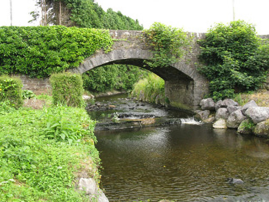
The Bridge in Mountcollins has a stone-lined basin and a weir beneath it to handle the rushing Caher. The river arrives roaring down the countryside and discovers somebody has run it a bath.
Single-span road bridge, built c. 1870, spanning the River Caher. Having camber-headed arch with rusticated limestone voussoirs and rubble stone soffit spring from rubble stone piers with rusticated tooled limestone quoins over rubble stone lined basin with weir to south-west. Rubble stone spandrels surmounted by splayed rubble stone parapet walls with rubble stone coping. Rubble stone-faced embankments to northern bank of river abutting bridge.
As an integral element of the early transport and communications network between the counties of Kerry and Limerick, this attractive road bridge is an important feature of the areas architectural heritage. The structure displays a high level of skill and craftsmanship in its construction, with features such as rusticated limestone quoins and voussoirs that form an expertly constructed arch. The visual contrast between the dressed limestone arch and the rubble stone walls also enliven the bridge faces. Located spanning the Caher River, the addition of stone embankments and a stone block basin reinforce the structural rigidity of the bridge against the fast flowing water.
From the Buildings of Ireland (National Inventory of Architectural Heritage) record 21905204
This does not grant access. Most recorded buildings are privately owned; view them only from public ground unless the owner allows entry.
Places near here
Photo credits
- National Inventory of Architectural Heritage
- Jonathan Thacker, Geograph · CC BY-SA 2.0
- Mike Searle, Wikimedia Commons · CC BY-SA 2.0
- A.-K. D., Wikimedia Commons · CC BY-SA 4.0
- Wikimedia Commons contributor · CC BY-SA 3.0
- Bernard, Geograph · CC BY-SA 2.0
- EecherplazGinkgo06.jpg : Cayambe derivative work: Ginkgotree ( talk ), Wikimedia Commons · CC BY-SA 3.0
- Marathon, Geograph · CC BY-SA 2.0
- David Dixon, Geograph · CC BY-SA 2.0
- Adrian Beney, Wikimedia Commons · CC BY-SA 2.0
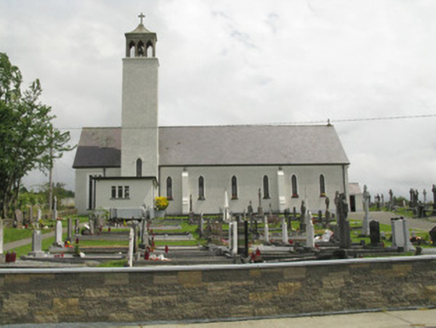 Catholic Church of Our Lady of the AssumptionChurch/chapel · 179 yd
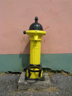 water pump308 yd
 Three CountiesPicnic place · 1.4 mi
 Glenquin CastleCastle · 7.0 mi
 Saint Ite's WellSpring · 8.1 mi
_-_geograph.org.uk_-_3037263.jpg/250px-Castles_of_Munster,_Kilmurry,_Kerry_(2)_-_geograph.org.uk_-_3037263.jpg "Photo: Mike Searle, Wikimedia Commons · CC BY-SA 2.0") Kilmurry CastleCastle · 8.6 mi
Kilmurry CastleCastle · 8.6 mi Crag CaveCave · 10 mi
 CrossCross, High cross · 20 mi
 Ginkgo21 mi
 Monsignor Hugh O'Flaherty MemorialMemorial · 21 mi
 Ross Castle RingwayWalking route · 22 mi
 Lamb IslandIsland · 23 mi
More historic places in County Limerick · All of County Limerick
What do you know about this place?