What is recorded here
From the National Monuments Service (Archaeological Survey of Ireland) record LH006-101002
Places near here
Photo credits
- National Inventory of Architectural Heritage
- Cathar11, Wikimedia Commons · CC0
- Eric Jones, Geograph · CC BY-SA 2.0
- Garry Dickinson, Geograph · CC BY-SA 2.0
- Eric Jones, Wikimedia Commons · CC BY-SA 2.0
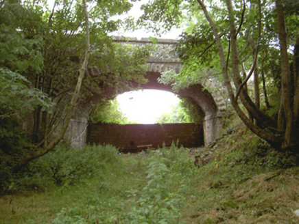 Tullagee BridgeBridge · 1694 yd
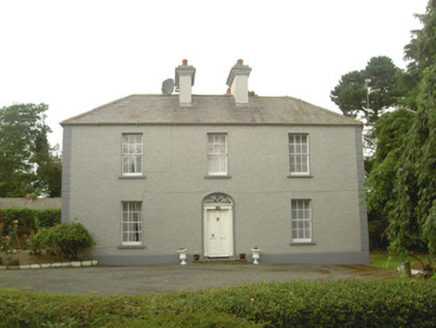 Tullagee HouseHouse · 1.2 mi
Explorer Tom Tullagee House has a dog who thinks he’s the landlord and barks at all authority. The grounds are lovely, but that pooch is running the whole operation. Snap one photo, then put the camera away before he bites it.
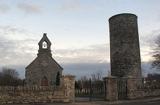 Round Tower2.0 mi
Explorer Tom Round Tower in Inishkeen Glebe was built after a suspicious bargain involving a goat and a very confused landlord. It’s got a doorway high enough to keep out short skeptics. Have a sandwich here and call it a heritage lunch.
 Promontory fortPromontory fort, inland · 2.7 mi
Explorer Tom Promontory fort in Slieve has had so many former names it’s lost count and just goes by 'that hill.' It’s an oval area on a ridge and thinks it’s mysterious. Stand back, squint, and it looks like a castle.
 Roche CastleCastle, Anglo-Norman masonry castle · 3.4 mi
Explorer Tom Roche Castle is guarded by seagulls who think they paid for the tickets themselves. It’s perched on a rock and judging your car park choice from above. Take a breath of that air, it's older than your car.
 Dun DealganCastle, motte and bailey · 4.1 mi
Explorer Tom Dun Dealgan in Castletown has seagulls that constantly heckle visitors for standing on its steep mound. The big bailey got chopped up by modern pipes, which is a bit rude. Snap one photo, then put the phone away and actually look.
 Ballsmill Amenity LandPicnic place · 4.4 mi
Explorer Tom Ballsmill Amenity Land sits right where Ballsmill Road meets Glasdrumman Road, perfect for a riverside picnic and a chat.
 Dundalk CentralHeritage attraction · 4.8 mi
 Urney GraveyardGraveyard · 5.5 mi
 Forkhill Greenspace PathwayWalking route · 6.1 mi
Explorer Tom Enjoy the Forkhill Greenspace Pathway, where a former army base has transformed into a peaceful woodland park.
 CroslieveMountain / peak · 6.2 mi
Explorer Tom This rocky knoll is an ancient volcanic vent reaching 360m, with stay wires for a blue light communications mast nearby.
 Mass Rock Loop TrailWalking route · 6.3 mi
Explorer Tom Loop around the Mass Rock Trail to find the Carrive Mass Rock shrine tucked behind the trees.
More memorials and graveyards in County Louth · All of County Louth

What do you know about this place?Tap to add a comment or ask a question