
Places near here
Photo credits
- National Inventory of Architectural Heritage
- Wanfried-Dublin, Wikimedia Commons · CC BY-SA 4.0
- Jamie Carroll, Geograph · CC BY-SA 2.0
- Dieglop, Wikimedia Commons · CC BY-SA 4.0
- Tjp finn, Wikimedia Commons · CC BY-SA 4.0
- Kieran Campbell, Geograph · CC BY-SA 2.0
- Ianfhunter, Wikimedia Commons · CC BY 4.0
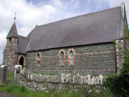 Saint Columba's Church (Moybolgue)Church/chapel · 1.4 mi
Explorer Tom Saint Columba's Church (Moybolgue) hosted one dance that really went too far back in the day. It’s derelict now but…
 Portal tomb in ErveyPortal tomb · 2.7 mi
Explorer Tom Portal tomb in Ervey is sitting pretty on that little col, looking like it just woke up from a nap. That massive…
 Slane CastleCastle, unclassified · 16 mi
Explorer Tom Slane Castle looks tough enough to survive a zombie attack by just standing there and judging everyone. It’s had a few…
 MonasteryEcclesiastical residence · 17 mi
Explorer Tom Monastery in Slanecastle Demesne is no longer visible, which means it’s probably just a bunch of stories about…
 Monastic RuinsChurch · 17 mi
Explorer Tom Monastic Ruins at Slanecastle are officially invisible, which is a great excuse for not finding them when you go…
 Church (in Ruins)Church · 19 mi
Explorer Tom Church in Monknewtown is hiding a scandal involving a chaplain named Thomas Alen who probably didn’t clean his boots…
 mill (water)19 mi
Explorer Tom This Mill in Monknewtown is proud of its red brick chimneystack more than it is of actually grinding grain. It…
 CastleCastle, tower house · 21 mi
Explorer Tom Castle in Monktown is locked in an eternal feud with the rain, and honestly, it’s losing badly. You’ve got a Cistercian…
 Skreen ChurchChurch · 23 mi
Explorer Tom Skreen Church in Skreen sits on a hill where Tara’s ridge looms like a giant's shoulder. A mythological king’s daughter…
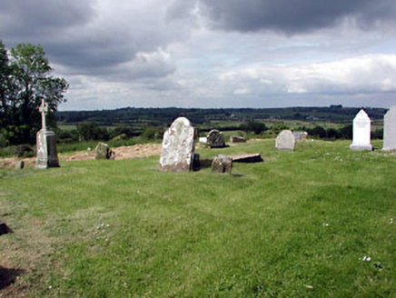 graveyard/cemetery23 mi
Explorer Tom Graveyard or cemetery in Skreen claims a fake royal visit that nobody can actually disprove. It’s packed with medieval…
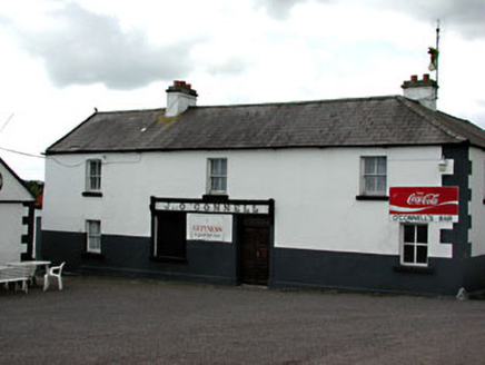 J. O'ConnellHouse · 23 mi
Explorer Tom J. O'Connell in Skreen would review its visitors as 'adequate, though they missed the carved brackets entirely.' Late…
 post box23 mi
Explorer Tom Post box in Skreen is a cast-iron beast with a crown that looks like it’s ready to rule a tiny kingdom of letters. The…
More archaeology and monuments in County Meath · All of County Meath

What do you know about this place?Tap to add a comment or ask a question