What is recorded here
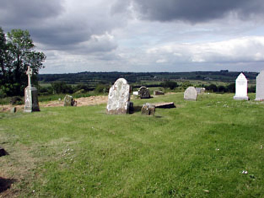
Graveyard or cemetery in Skreen is dated around 1770, but contains a fifteenth-century church and the seventeenth-century Marward Stone. Ask this place its age and it starts counting from when it changed its coat.
Roman Catholic graveyard, c.1770, on the site of a fifteenth-century church, the remains of which are located in the centre of the graveyard. Medieval stone cross with a carved crucifixion panel to the north-east. The Marward Stone, which dates to the early seventeenth century, is located to the east of the church. Bounded by rubble limestone walls with limestone gate piers and wrought-iron double gate. .
Skreen graveyard contains many interesting examples from many different periods, of the various materials, forms and designs employed for grave markers. The site is bounded by a rubble limestone wall, which enhances the hill top setting. The medieval elements add archaeological interest to this site, which has clearly been a focus of religious activity in the area for many centuries.
From the Buildings of Ireland (National Inventory of Architectural Heritage) record 14326009
This does not grant access. Most recorded buildings are privately owned; view them only from public ground unless the owner allows entry.
Places near here
Photo credits
- Ianfhunter, Wikimedia Commons · CC BY 4.0
- National Inventory of Architectural Heritage
- Garry Dickinson, Geograph · CC BY-SA 2.0
- Kieran Campbell, Geograph · CC BY-SA 2.0
- Patrick Brown, Wikimedia Commons · CC BY-SA 2.0
- Anthony Foster, Geograph · CC BY-SA 2.0
- Anthony Foster, Wikimedia Commons · CC BY-SA 2.0
- Neil Forrester, Co.Meath, Ireland. http://neil.forrester.ie, Wikimedia Commons · CC BY 3.0
- William Murphy, Wikimedia Commons · CC BY 2.0
- C O'Flanagan, Wikimedia Commons · CC BY-SA 2.0
 Skreen ChurchChurch · 9 yd
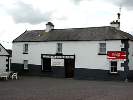 J. O'ConnellHouse · 55 yd
 Skreen CastleCastle, tower house · 395 ydCandle HillMountain / peak · 1323 ydClusker Wood SouthWood · 1.9 mi
 CastleCastle, tower house · 1.9 mi
 Hill of TaraVisitor information · 1.9 mi
 Saint Patrick'sMemorial · 2.0 mi
 Dumha na nGiallArchaeological place · 2.0 mi
 Battle of Tara HillBattle · 2.1 mi
 Battle of Tara (Ireland)Major battlefield · 2.1 mi
 Rath MeaveHenge · 2.3 mi
More historic places in County Meath · All of County Meath
What do you know about this place?