
What is recorded here
Near the top of a short gentle E-facing slope, in tillage, near the centre of a very large but levelled early ecclesiastical enclosure (KD035-012, 2-). Shown on the 1st ed. (1839) of the OS 6-inch map as a triangular area (est. c. 40m E-W; est. max. c. 30m N-S), but recorded as circular on the current ed. (1939) of the…
Read the whole record
From the National Monuments Service (Archaeological Survey of Ireland) record KD035-012004
Places near here
Picture notes
- Computer-made picture. It does not show this monument.
- Alex Passmore, Wikimedia Commons · CC BY-SA 2.0
- Malene Thyssen, Wikimedia Commons · CC BY-SA 3.0
- National Inventory of Architectural Heritage
- Enna, Wikimedia Commons · Public domain
- Computer-made picture. It does not show this playground.
- Hello, I am Bruce on Flickr, Wikimedia Commons · CC BY-SA 2.0
- Computer-made picture. It does not show this walking route.
 Ecclesiastical enclosure in ArdscullEcclesiastical enclosure · 1 ydComputer-made picture
Explorer Tom Ecclesiastical enclosure in Ardscull was designed by a mother-in-law who loved boundaries and hated being close to anyone. Two massive concentric circles surround the church, like a very serious hug. Wave at the cows, they're the real locals.
 Children's burial ground in ArdscullChildren's burial ground · 262 ydComputer-made picture
Explorer Tom Children's burial ground in Ardscull has caught my eye in Ardscull, County Kildare. I bet a children's burial ground with a name like that could keep me talking all afternoon; I'm already inventing a daft little scene for it, and I'll stop before it turns into history.
 Enclosure in ArdscullEnclosure · 683 ydComputer-made picture
Explorer Tom Enclosure in Ardscull is the shortcut that isn't a shortcut, leading you nowhere but deeper into confusion. It’s oval, truncated by field boundaries, and basically hiding from the ploughs. Linger, it's not going anywhere and neither should you.
 History of Moat of ArdscullVisitor information · 1535 yd
Explorer Tom History of Moat of Ardscull has caught my eye in County Kildare. I bet a visitor information with a name like that could keep me talking all afternoon; I'm already inventing a daft little scene for it, and I'll stop before it turns into history.
 European Beech1537 yd
Explorer Tom European Beech has caught my eye in County Kildare. I bet a european beech with a name like that could keep me talking all afternoon; I'm already inventing a daft little scene for it, and I'll stop before it turns into history.
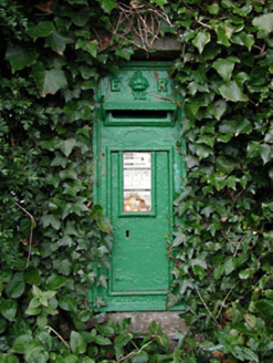 post box1571 yd
Explorer Tom This Ardscull post box has a crown on top because a bishop refused to visit unless it looked regal enough. It still works perfectly at the crossroads, collecting letters while the rest of the village ignores its royal status. Sit on a wall near it and feel fancy.
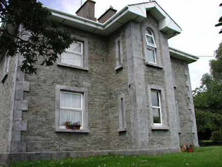 The GroveRic barracks · 1585 yd
Explorer Tom The Grove in Ardscull had a bishop refuse to visit because he didn't like the vibe, which still stings. The old barracks walls are probably laughing at his decision right now. Spot the oldest stone and see if it winks at you, they do that.
 Ardscull MoatCastle, motte · 1587 yd
Explorer Tom Ardscull Moat sits on a hilltop claiming it saw a battle between Leinstermen and Munstermen back in the second century. That’s a long time to be waiting for proof. Perfect spot to practise your best tour-guide voice.
_(page_1_crop).jpg/250px-Inch_Castle,_Co._Kildare,_1835_(IA_jstor-30003809)_(page_1_crop).jpg "Photo: Enna, Wikimedia Commons · Public domain") Inch CastleCastle, tower house · 1.2 mi
Inch CastleCastle, tower house · 1.2 miExplorer Tom Inch Castle in County Kildare started because two lads bet they could build it before lunch. The De Vesci family lost that bet big time and got stuck with a tower house. Get a photo with it before it gets a better agent.
 Children's playground1.4 miComputer-made picture
Explorer Tom Children's playground has caught my eye in County Kildare. I bet a children's playground with a name like that could keep me talking all afternoon; I'm already inventing a daft little scene for it, and I'll stop before it turns into history.
 Scots Pine1.7 mi
Explorer Tom Scots Pine here is having a go at being famous because some other pine got the credit years ago. It’s basically the cousin who shows up to weddings uninvited. Perfect detour when the satnav has a meltdown.
 The Barrow WayWalking route · 4.8 miComputer-made picture
Explorer Tom The Barrow Way has caught my eye in County Kildare. I bet a walking route with a name like that could keep me talking all afternoon; I'm already inventing a daft little scene for it, and I'll stop before it turns into history.
More archaeology and monuments in County Kildare · All of County Kildare

What do you know about this place?Tap to add a comment or ask a question