What is recorded here
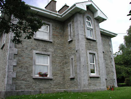
The Grove at Ardscull was a police barracks, and even its corner stone carries a surveyor’s mark fixing its height above sea level. You’d have had a hard time being vague in there. ‘Where were you standing?’ ‘Outside.’ ‘We’ll need that considerably more precise.’
Detached three-bay two-storey rubble stone former Royal Irish Constabulary barracks, c.1830, with single-bay two-storey gabled projecting bay to centre and two-bay two-storey lean-to lower return to rear to north originally single-storey. Extensively renovated and extended, c.1970, comprising three-bay single-storey flat-roofed rubble stone return to rear to north with first floor added to original return to accommodate residential use. Part refenestrated, c.1990. Hipped roof (gabled to projecting bay; lean-to to return to rear to north). Replacement artificial slate, c.1970. Concrete ridge tiles. Rendered chimney stacks. Replacement uPVC eaves, c.1990. Replacement uPVC rainwater goods, c.1990. Flat-roof to additional return behind rubble stone parapet wall. Materials not visible. Rubble stone walls (possibly originally rendered). Cut-stone quoins to corners. Roughcast to rear elevation to north. Unpainted. Rubble stone walls to additional return. Rubble stone parapet wall. Square-headed window openings (slit-style to projecting bay; round-headed to first floor projecting bay). Cut-stone sills. Cut-stone surrounds. Concrete sills to additional return. Replacement timber casement windows, c.1970, to rear elevation to north. Replacement uPVC casement windows, c.1990, to front elevation to south. Square-headed door opening. Cut-stone surround. Replacement glazed timber panelled door, c.1970. Set back from road in own grounds on a corner site. Lawns to front.
The Grove is an attractive, symmetrically-designed former Royal Irish Constabulary Barracks that is now in residential use - its original use is of social and historical importance as the civic centre of the locality. Although altered considerably in the late twentieth century, the original character of the structure is nevertheless recognisable, most notably in the front (south) elevation. The building is of sound construction and the juxtaposition of rubble stone with cut-stone dressings achieves a pleasant, quasi-polychromatic effect whilst revealing the high quality of stone masonry practised in the locality. The presence of a bench mark to one quoin is of scientific interest, having been used in the early preparation of maps by the Ordnance Survey. The building is prominently located on the Ardscull Crossroads and is an attractive landmark in the locality.
From the Buildings of Ireland (National Inventory of Architectural Heritage) record 11903507
This does not grant access. Most recorded buildings are privately owned; view them only from public ground unless the owner allows entry.
Places near here
Photo credits
- National Inventory of Architectural Heritage
- Malene Thyssen, Wikimedia Commons · CC BY-SA 3.0
- Alex Passmore, Wikimedia Commons · CC BY-SA 2.0
- Hello, I am Bruce on Flickr, Wikimedia Commons · CC BY-SA 2.0
- Mgtmquinn, Wikimedia Commons · CC BY-SA 4.0
- Sheila1988, Wikimedia Commons · CC BY-SA 4.0
- Andrewmc, Wikimedia Commons · CC0
- John Michael Wright, Wikimedia Commons · Public domain
- Gerd Eichmann, Wikimedia Commons · CC BY-SA 4.0
- Andreas F. Borchert, Wikimedia Commons · CC BY-SA 4.0
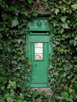 post box14 yd
 European Beech412 yd
 History of Moat of ArdscullVisitor information · 422 yd
 Ardscull MoatCastle, motte · 505 yd
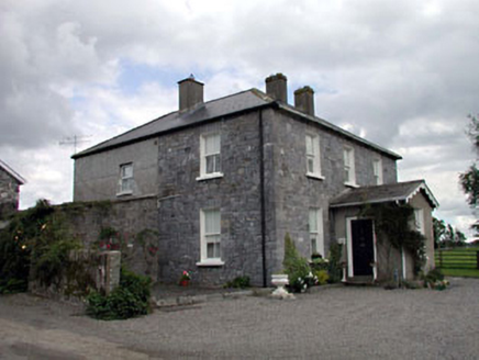 Moat LodgeFarm house · 770 yd
 Scots Pine1.4 mi
 Town HallMuseum · 3.4 mi
 Woodstock Castle (in Ruins)Castle, hall-house · 3.4 mi
 Ernest ShackletonMemorial · 3.4 mi
 Battle of KilrushBattle · 3.6 mi
 CrossCross, High cross · 4.9 mi
 Stone CrossCross, High cross · 4.9 mi
More historic places in County Kildare · All of County Kildare
What do you know about this place?