
What is recorded here
A subrectangular area (c. 42m NW-SE; c. 23m NE-SW at the SE end; 38m at the NW end) enclosed by a stone wall (T 0.4m). The NW wall (L c. 5m; H 2.5m; Wth 0.92m) has a segmental-arched entrance gate (Wth 1.8m; H 1.8m; T 1m) at its NE end. The graveyard has been extended on the SW side and part of the original SW wall…
Read the whole record
From the National Monuments Service (Archaeological Survey of Ireland) record SL034-048002
Places near here
Photo credits
- Maker not stated on source page, www.alamy.com
- Maker not stated on source page, www.pinterest.com
- Maker not stated on source page, en.wikipedia.org
- Maker not stated on source page, www.flickr.com
- Maker not stated on source page, www.wikidata.org
- National Inventory of Architectural Heritage
- HistoricalFictionAuthor, Wikimedia Commons · CC BY-SA 4.0
- Maker not stated on source page, commons.wikimedia.org
- Gaius Cornelius, Wikimedia Commons
 Fairy fort / earthen ringfort in ArdaghFairy fort / earthen ringfort · 660 yd
Explorer Tom Ardgallin’s rath is half-gone because the weather has a long-standing grudge against it being so round. Only the west…
Fairy fort / earthen ringfort in ArdvarneyFairy fort / earthen ringfort · 1098 ydExplorer Tom Ardvarney’s forest fort swears by a local superstition that if you whistle at the stone core, the pines will grow an…
 Church in Drumdoney (tirerrill By., Killadoon Ed)Church · 1498 yd
Explorer Tom Church in Drumdoney: There’s serious drama between this church and the nearest tree, because the tree keeps dropping…
 Holy well in DrumcolumbHoly well · 1552 yd
Explorer Tom Holy well in Drumcolumb was recorded back in 1836, but now there are no visible remains left for anyone to complain…
 Fairy fort / earthen ringfort in Emlagh (tirerrill By.)Fairy fort / earthen ringfort · 1604 yd
Explorer Tom This fairy fort in Emlagh makes a weird sound at night that locals swear is just the wind, but I bet you it’s…
 Fairy fort / earthen ringfort in Drumraine (tirerrill By.)Fairy fort / earthen ringfort · 1636 yd
Explorer Tom Drumraine’s D-shaped fort was saved by a hero nobody remembers, probably a goat that ate the right weeds. It looks like…
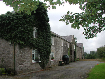 Ardagh HouseFarmyard complex · 1.1 mi
Explorer Tom Ardagh House in Bellanascarva has converted farm buildings that now hide a message about survival in their symmetrical…
 Catholic Church of the Sacred HeartChurch/chapel · 1.7 mi
Explorer Tom Catholic Church of the Sacred Heart in Ardkeeran seems to have been built by someone who got slightly turned around on…
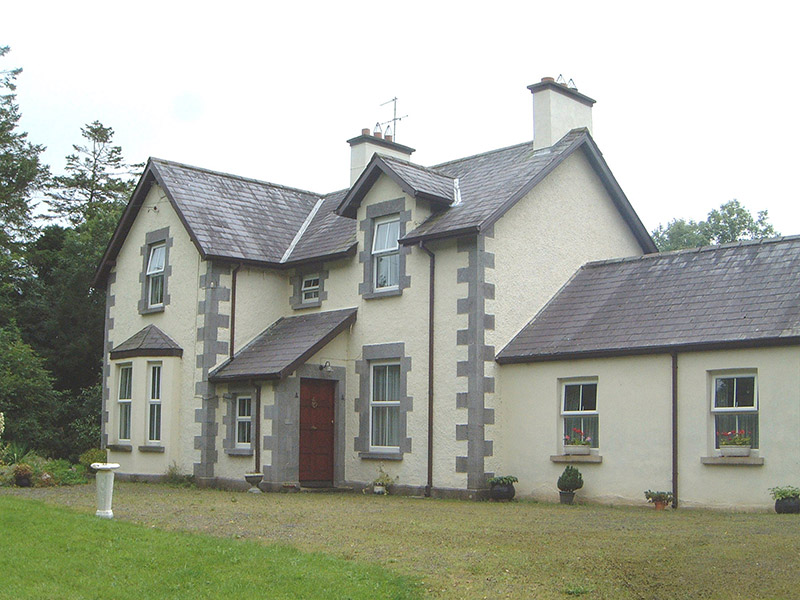 KingsvilleHouse · 1.8 mi
Explorer Tom Kingsville in Cuiltylough hears the neighbours arguing about whose turn it is to buy the milk through its thick walls.…
 Enclosure in Tawnagh (tirerrill By.)Enclosure · 1.8 mi
Explorer Tom Enclosure in Tawnagh is hiding inside another fort, which is like living with your boss and his terrible jokes. A local…
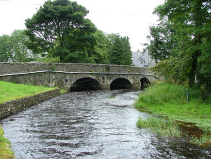 bridge1.8 mi
Explorer Tom Bridge in Ardcumber was built by a man who thought if he made it wide enough, no horse would ever fall off, which was…
 Riverstown Folk ParkVisitor attraction · 1.8 mi
Explorer Tom Riverstown Folk Park, now welcoming visitors as Sligo Folk Park, turns six acres in the village into a small world of…
More archaeology and monuments in County Sligo · All of County Sligo

What do you know about this place?Tap to add a comment or ask a question