
What is recorded here
From the National Monuments Service (Archaeological Survey of Ireland) record LH019-023
Places near here
Photo credits
- Maker not stated on source page, en.wikipedia.org
- Kieran Campbell, Geograph · CC BY-SA 2.0
- Maker not stated on source page, www.neverstoptraveling.com
- National Inventory of Architectural Heritage
- Maker not stated on source page, ch.pinterest.com
- Maker not stated on source page, au.pinterest.com
- Kieran Campbell, Geograph · Creative Commons Attribution-ShareAlike 2.0
- Garry Dickinson, Geograph · CC BY-SA 2.0
 Standing stone in LabanstownStanding stone · 983 yd
Explorer Tom Standing stone in Labanstown would survive a reality show by just standing there and judging everyone else's haircuts.…
 Church in LabanstownChurch · 1201 yd
Explorer Tom Church in Labanstown likes singing 'The Swan Lake' because it feels like floating on clouds. It’s known locally as St.…
 Church (in ruins)Church · 1261 yd
Explorer Tom Church in Parsonstown would buy a new roof with a lotto win, but it's too lazy to check numbers. It’s been standing…
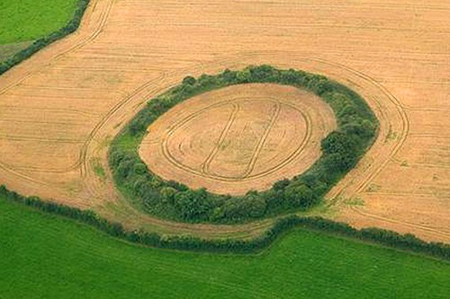 Fairy fort / earthen ringfort in Nicholastown (ferrard By.)Fairy fort / earthen ringfort · 1519 yd
Explorer Tom Locals swear by a superstition here that if you step inside this circle without permission, your shoelaces will stay…
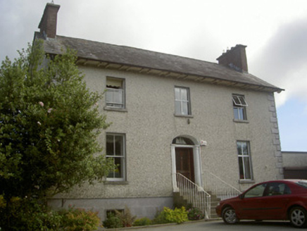 Seaview HouseHouse · 1.2 mi
Explorer Tom Seaview House would bring a full three-course meal to any party, no questions asked. It’s sitting up high on a basement…
 Glebe East Church RuinRuins · 1.5 mi
Explorer Tom Glebe East Church Ruin in County Louth looks like it fell over from boredom rather than age, leaving just enough stone…
 Togher HouseHouse · 1.5 mi
Explorer Tom Togher House in Togher is just standing there judging you with its substantial chimneystacks and…
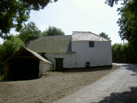 mill (water)1.6 mi
Explorer Tom Mill in Milltown is giving me the stink-eye, and honestly? I think the local rabbits are plotting a union strike over…
 MilltownHouse, 17th century · 1.6 mi
Explorer Tom Milltown House has mud walls faced with stone and a half-hipped roof that looks slightly lopsided. Its unlikely…
 Mapped cemeteryCemetery · 1.7 mi
Explorer Tom Mapped cemetery in County Louth has a curse that only affects people who don’t wave when they pass by the gate. If…
 Catholic Church of Saint Peter and Saint PaulChurch/chapel · 1.7 mi
Explorer Tom Catholic Church of Saint Peter and Saint Paul would tell the place that replaced it to stop hogging all the attention.…
 Castle in ClonmoreCastle, tower house · 1.9 mi
Explorer Tom Castle in Clonmore has a hidden treasure that is definitely just a biscuit tin left by a confused Victorian lady. Only…
More archaeology and monuments in County Louth · All of County Louth

What do you know about this place?Tap to add a comment or ask a question