
What is recorded here
In rough hill pasture, on the S-facing slope of Coombane Hill. The remains of a system of relict field walls (T 0.4-0.8m; H 0.1-0.8m), which protrude intermittently above the surface of the bog, meander in different directions with no definite pattern apparent. The main section of relict field wall winds from N to S…
Read the whole record
From the National Monuments Service (Archaeological Survey of Ireland) record KE084-022
Places near here
Photo credits
- Maker not stated on source page, www.pinterest.com
- Maker not stated on source page, www.flickr.com
- Maker not stated on source page, nexusnewsfeed.com
- Maker not stated on source page, www.irelandhighlights.com
- Maker not stated on source page, www.britainexpress.com
- Nunulark, Wikimedia Commons · CC0
- Maker not stated on source page, www.stpeters.connor.anglican.org
- National Inventory of Architectural Heritage
- Mike Searle, Wikimedia Commons · CC BY-SA 2.0
- Tripadvisor visitor; individual photographer not stated, Tripadvisor visitor
- Graham Horn, Geograph · CC BY-SA 2.0
 Enclosure in DerreenacahillEnclosure · 29 yd
Explorer Tom Enclosure in Derreenacahill was once ruled by a goat with serious opinions on architecture. The boulder inside is just…
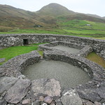 Enclosure in Fustane LowerEnclosure · 211 yd
Explorer Tom Enclosure in Fustane Lower is where the Vikings got lost and decided to build a wall instead of turning around. The…
 Fairy fort / earthen ringfort in CummeenboyFairy fort / earthen ringfort · 1556 yd
Explorer Tom Fairy fort / earthen ringfort in Cummeenboy has been hiding a scandal about stolen cattle for centuries. The bank is…
 Fairy fort / earthen ringfort in Gortnaboul LowerFairy fort / earthen ringfort · 1.3 mi
Explorer Tom Fairy fort in Gortnaboul Lower would ace a job interview by bragging about its massive external height of over four…
 Fairy fort / earthen ringfort in Istalea LowerFairy fort / earthen ringfort · 1.3 mi
Explorer Tom Fairy fort in Istalea Lower is hiding a treasure chest that definitely contains only stale biscuits and a broken…
 Standing stone in Gortnaboul LowerStanding stone · 1.5 mi
Explorer Tom Standing stone in Gortnaboul Lower would tell its younger self to stop worrying about that notch on its side. It’s just…
 KnockrowerMountain / peak · 2.0 mi
Explorer Tom Knockroe in County Kerry would bring its own dislodged capstone to any party as a conversation starter. It’s like a…
 St. Peters ChurchChurch · 3.3 mi
Explorer Tom St. Peters Church has been hiding a scandal involving a priest, a goat, and a very expensive hat for centuries. The…
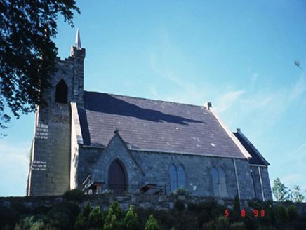 Michael J. Quill CentreChurch/chapel · 3.3 mi
Explorer Tom Michael J. Quill Centre in Fussa is hiding a secret message in its stones, probably about bad biscuits. It's a church…
 Battle of CallannBattle · 4.6 mi
Explorer Tom Battle of Callan in Kerry suspects the postman is spying on its grave marker. Donal fell here, so it’s got a lot of…
 Kilgarvan Motor MuseumMuseum · 4.8 mi
Explorer Tom Kilgarvan Motor Museum at Slaheny has the dangerous power to make even a sensible driver say, “Just one more car,” for…
 Bird HillMountain / peak · 6.0 mi
Explorer Tom Bird Hill in County Kerry has a ghost who is too lazy to haunt anyone because he’s napping under a bush. He only wakes…
More archaeology and monuments in County Kerry · All of County Kerry

What do you know about this place?Tap to add a comment or ask a question