
Places near here
Photo credits
- Eric Jones, Geograph · CC BY-SA 2.0
- National Inventory of Architectural Heritage
- Robert Ashby, Geograph · Creative Commons Attribution-ShareAlike 2.0
- Kmcnamee, Wikimedia Commons · CC BY-SA 4.0
- Eric Jones, Geograph · Creative Commons Attribution-ShareAlike 2.0
 Grange UpperMountain / peak · 667 yd
Explorer Tom Grange Upper hears everything through its walls, including the sound of your footsteps and the internal monologue of…
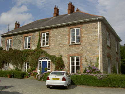 Castletown HouseHouse · 939 yd
Explorer Tom Castletown House is trying to win a county fair for 'Most Confusing Window Levels'. It was built in stages and shows…
 The BushPicnic place · 1600 yd
Explorer Tom The Bush is a picnic place where a priest lost a bet to a farmer over who could throw an apple further into the trees.…
 Saint Andrew's Church (Carlingford)Church/chapel · 1633 yd
Explorer Tom Saint Andrew's Church (Carlingford) made its New Year's resolution to stop letting the nettles take over. The Upton…
 Newtown Burying GroundGraveyard · 1.2 mi
Explorer Tom Newtown Burying Ground in Mountbagnall is sitting next to a motte that probably used to be a castle but now just looks…
 BarnavaveMountain / peak · 1.4 mi
Explorer Tom Barnavave would tell you in a job interview that it has excellent stability skills because it hasn't moved an inch…
 Fr. Mc Evoy Park, Cooley KickhamsGAA ground · 1.6 mi
 Carlingford - Loop 1A- Commons LoopWalking route · 2.1 mi
Explorer Tom Carlingford - Loop 1A- Commons Loop in County Louth would survive a zombie attack by hiding behind its overgrown bushes…
 Ballug CastleCastle, tower house · 2.1 mi
Explorer Tom Ballug Castle in County Louth is falling apart so fast it’s barely holding itself together with hope and rubble. It…
 Carlingford Heritage CentreVisitor information · 2.3 mi
Explorer Tom Carlingford Heritage Centre occupies the old Church of the Holy Trinity, which has spent centuries watching this County…
 Graveyard in Liberties of CarlingfordGraveyard · 2.3 mi
Explorer Tom This graveyard in Carlingford is inter-denominational, meaning everyone gets along despite the religious differences.…
 TholselGatehouse · 2.3 mi
Explorer Tom Tholsel in Carlingford is a gatehouse that lost its top floor, making it look perpetually shrunk or slightly…
More archaeology and monuments in County Louth · All of County Louth

What do you know about this place?Tap to add a comment or ask a question