What is recorded here
Marked as a circular embanked enclosure (ext. diam. c. 35m) on the 1840 ed. of the OS 6-inch map and as an oval enclosure (ext. dims. c. 65m E-W; c. 50m N-S) on the 1927 ed. Situated on a gentle S-facing slope. Overgrown oval area (dims. c. 40m E-W; c. 20m N-S) defined by a stone wall (Wth 3m; H 1m at N). There is no visible fosse or entrance.
From the National Monuments Service (Archaeological Survey of Ireland) record WA014-019
The monument record does not grant public access. Check the route and ask the landowner before entering private land.
- What survives
- Recorded monument
Places near here
 Comeragh HouseHouse · 523 ydIndicatedEnclosure · 645 yd
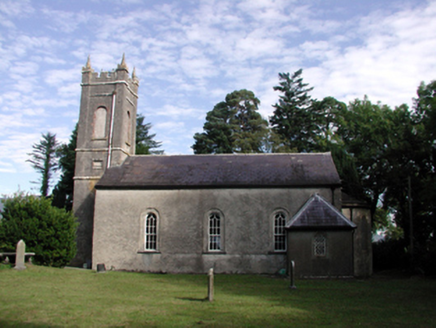 Kilrossanty ChurchChurch/chapel · 928 ydSite of CastleCastle, unclassified · 984 ydMan-made underground passage in KilcomeraghMan-made underground passage · 1042 ydCrough WoodWood · 1617 ydSite of CastleCastle, unclassified · 1.3 mi
 Mahon ValleyCliff · 2.5 mi
 Mahon FallsWaterfall · 2.8 mi
 KnockaunapeebraMountain / peak · 3.0 mi
 CoumfeaMountain / peak · 3.6 mi
 CoumshingaunMountain corrie and lake · 3.6 mi
Pictures: National Inventory of Architectural Heritage; kevin higgins, Geograph · CC BY-SA 2.0; Rwxrwxrwx at English Wikipedia, Wikimedia Commons · Public domain; Colin Park, Geograph · CC BY-SA 2.0; Kevin O'Brien 13, Wikimedia Commons · CC BY-SA 4.0
More archaeology and monuments in County Waterford · All of County Waterford
What do you know about this place?