
What is recorded here
Detached five-bay two-storey house, c.1825, with single-bay single-storey end bay to right (west), single-bay two-storey canted bay to side elevation to left (east), single-bay two-storey return to south-east, and four-bay two-storey lower return to south-west. Burnt, 1923. Extensively reconstructed, post-1925. Burnt, c.1975. Extensively reconstructed, post-1975, with two-bay single-storey flat-roofed entrance bay added to front (north) elevation having prostyle tetrastyle Tuscan portico to left (east). Pitched roofs (behind parapet to end bay; half-polygonal to canted bay) with replacement artificial slate, post-1975, clay ridge tiles, rendered chimney stacks, rendered coping, and iron rainwater goods on rendered eaves. Flat roof to entrance bay not visible behind parapet. Painted roughcast walls with rendered chimney breast to front (north) elevation, crow-stepped parapet to end bay, and concrete coping to parapet to entrance bay. Square-headed window openings with replacement concrete sills, post-1975, and replacement timber casement windows, post-1975. Round-headed door opening under prostyle tetrastyle Tuscan portico (having cut-stone columns on pedestal supporting frieze and moulded cornice) with replacement glazed timber panelled door, post-1975, overlight, and round-headed flanking window openings with replacement concrete sills, post-1975, and replacement fixed-pane timber windows, post-1975. Set back from road in own grounds with gravel forecourt, and landscaped grounds to site.
A substantial house of irregular quality, the present form and massing resulting from two phases of comprehensive renovation works in the early and late twentieth century. The house is of particular interest for its associations with “The Troubles” (1922 – 1923), which necessitated the first phase of reconstruction. Although much of the original fabric has been lost, the house retains some of its early character, and remains an important feature in the landscape.
From the Buildings of Ireland (National Inventory of Architectural Heritage) record 22901507
This does not grant access. Most recorded buildings are privately owned; view them only from public ground unless the owner allows entry.
Places near here
IndicatedEnclosure · 407 ydEnclosure in ComeraghhouseEnclosure · 523 yd Kilrossanty ChurchChurch/chapel · 895 ydComeragh LodgeHouse · 901 ydSite of CastleCastle, unclassified · 937 ydCrough WoodWood · 1.1 miMahon ValleyCliff · 2.8 miMahon FallsWaterfall · 3.0 miKnockaunapeebraMountain / peak · 3.2 miCoumshingaunMountain corrie and lake · 3.8 miCoumfeaMountain / peak · 3.8 miStradbally CoveBeach / strand · 5.4 mi
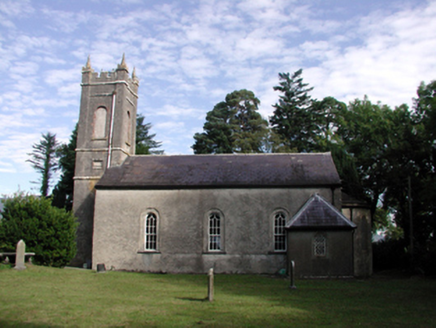 Kilrossanty ChurchChurch/chapel · 895 yd
 Comeragh LodgeHouse · 901 ydSite of CastleCastle, unclassified · 937 ydCrough WoodWood · 1.1 mi
 Mahon ValleyCliff · 2.8 mi
 Mahon FallsWaterfall · 3.0 mi
 KnockaunapeebraMountain / peak · 3.2 mi
 CoumshingaunMountain corrie and lake · 3.8 mi
 CoumfeaMountain / peak · 3.8 mi
 Stradbally CoveBeach / strand · 5.4 mi
Pictures: National Inventory of Architectural Heritage; kevin higgins, Geograph · CC BY-SA 2.0; Rwxrwxrwx at English Wikipedia, Wikimedia Commons · Public domain; Kevin O'Brien 13, Wikimedia Commons · CC BY-SA 4.0; Colin Park, Geograph · CC BY-SA 2.0; John M, Geograph · CC BY-SA 2.0
More historic places in County Waterford · All of County Waterford
What do you know about this place?