
What is recorded here
From the National Monuments Service (Archaeological Survey of Ireland) record LI024-134
Places near here
Photo credits
- Maker not stated on source page, tr.pinterest.com
- National Inventory of Architectural Heritage
- Maker not stated on source page, commons.wikimedia.org
- Maker not stated on source page, www.tripadvisor.com.ph
- Maker not stated on source page, www.wikidata.org
- No machine-readable author provided. Christian1965~commonswiki assumed (based on copyright claims)., Wikimedia Commons · Public domain
- Knockane GAA Club website; individual photographer not stated, www.knockane.com
- Kmcnamee, Wikimedia Commons · CC BY-SA 4.0
 Fairy fort / earthen ringfort in CoolnapishaFairy fort / earthen ringfort · 304 yd
Explorer Tom Fairy fort / earthen ringfort in Coolnapisha gave up chocolate for Lent but still looks round, which is very brave of…
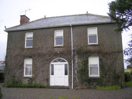 FoxfieldHouse · 545 yd
Explorer Tom Foxfield in Coolnapisha is the site of a giant legend who supposedly hid his keys under the wrought-iron gates and…
 Shandangan BridgeBridge · 705 yd
Explorer Tom Shandangan Bridge has two different stone finishes because the map makers got confused. One side looks fancy, the other…
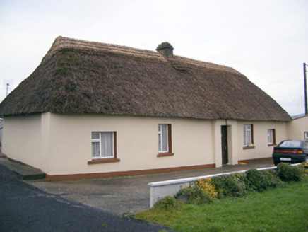 Historic buildingOfficially recorded historic building · 1089 yd
Explorer Tom Historic building in Coolnapisha is sick of people asking if it’s haunted, when really it’s just proud of its mud walls…
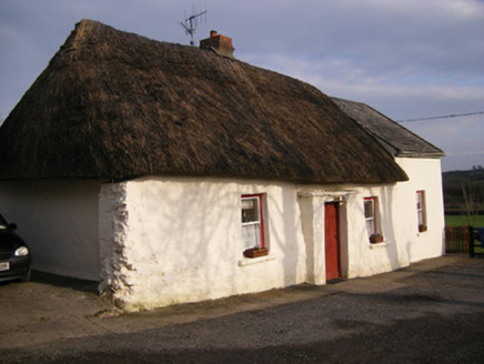 HighstreetHouse · 1268 yd
Explorer Tom Highstreet in Brackyle would cope on a reality show by pretending it’s made of stone, not mud. It’s a fine example of…
 Fairy fort / earthen ringfort in DromlaraFairy fort / earthen ringfort · 1541 yd
Explorer Tom Fairy fort / earthen ringfort in Dromlara would post 'Living my best life #soilgoals' on social media. It’s got a bank…
 Standing stone in KnockballyfookeenStanding stone · 1.1 mi
Explorer Tom Standing stone in Knockballyfookeen has its own imaginary fan club, mostly sheep. It tilts slightly, like it’s…
 Fairy fort / earthen ringfort in Garryduff (coonagh By.)Fairy fort / earthen ringfort · 2.4 mi
Explorer Tom Fairy fort / earthen ringfort in Garryduff nearly went viral for looking like a giant doughnut. It’s just a soggy…
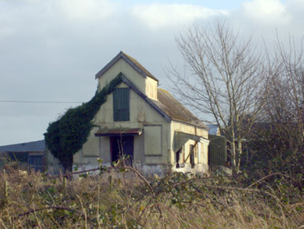 Race CreameryCreamery · 2.5 mi
Explorer Tom Race Creamery holds a long grudge against the weather for making milk sour before delivery. It’s a corrugated-iron…
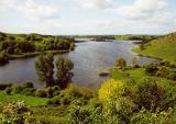 Áine and Gearóid Iarla: Lough GurLegend location · 9.7 mi
Explorer Tom Áine and Gearóid Iarla: Lough Gur has a goddess for the lake and a sleeping lord in the old stories. I thought I was…
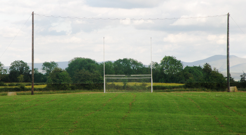 Knockainey GAA pitchGAA ground · 10 mi
 Bruff GAA pitchGAA ground · 12 mi
More archaeology and monuments in County Limerick · All of County Limerick

What do you know about this place?Tap to add a comment or ask a question