What is recorded here
Situated on a break of slope with land falling away to the SW, in very undulating, rough pasture with a lot of outcrop and drainage activity. An ecclesiastical site founded by Augustinian canons in the twelfth/thirteenth century (Gleeson 1915, vol. 2, 347). Referred to as the 'rectory of Twomahone' in the Royal…
Read the whole record
From the National Monuments Service (Archaeological Survey of Ireland) record TN018-010002
Places near here
Photo credits
- National Inventory of Architectural Heritage
- Maker not stated on source page, www.megalithic.co.uk
- Maker not stated on source page, sacredsites.com
- Mike Searle, Geograph · CC BY-SA 2.0
- dougf, Wikimedia Commons · CC BY-SA 2.0
- Maker not stated on source page, it.pinterest.com
- Maker not stated on source page, en.m.wikipedia.org
- Kmcnamee, Wikimedia Commons · CC BY-SA 4.0
 Timoney ParkGate lodge · 857 yd
Explorer Tom Timoney Park gate lodge would bring a very stiff neck and three different types of brick to any party, making everyone…
 Standing stone (present location) in Timoney HillsStanding stone (present location) · 919 yd
Explorer Tom Standing stone in Timoney Hills is one of four stones that might have been standing once, but now they’re just lying…
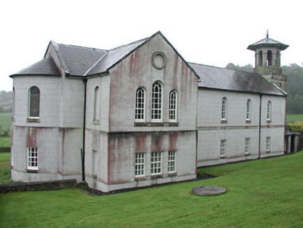 Christ Church (Corbally)Mill (water) · 1153 yd
Explorer Tom Christ Church in Corbally is having a dramatic standoff with the nearest tree, which keeps trying to claim its…
 The RectoryRectory/glebe/vicarage/curate's house · 1216 yd
Explorer Tom The Rectory in Cappalahan has bay windows and parapets that make it look like a Victorian doll’s house gone wrong. It…
 Anomalous stone group in CullaunAnomalous stone group · 1240 yd
Explorer Tom Anomalous stone group in Cullaun, County Tipperary, has twenty-one stones but only three are still standing straight…
 Tinderry HouseHouse · 1.3 mi
Explorer Tom Tinderry House has windows everywhere except where you’d expect them, making it look like it’s mid-argument with…
 Saint Patrick's Catholic ChurchChurch/chapel · 1.3 mi
Explorer Tom Saint Patrick's Catholic Church in Rockforest was once ruled by a goat named Bessie who ate all the altar flowers and…
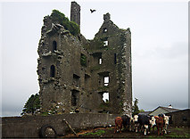 Castle (in Ruins)Castle, tower house · 1.8 mi
Explorer Tom Castle in Garranmaconly is gone, but the matchmaker who worked there still sends letters to no one. Four storeys of…
 Ballaghmore CastleCastle, tower house · 3.4 mi
Explorer Tom Ballaghmore Castle has been hiding a scandal since the sixteenth century that involves Cromwell taking a sledgehammer…
 Graveyard in Castlefleming Stubber,castlefleming or HeathGraveyard · 3.8 mi
Explorer Tom Graveyard in Castlefleming Stubber was once ruled by a very opinionated goat who decided it knew where all the children…
 St. Burchins Church and graveyardGraveyard · 4.2 mi
Explorer Tom St. Burchins Church and graveyard in Ballyhenry has a superstition locals swear by: don’t step on the old stones or…
 Ballyskenagh GAA pitchGAA ground · 5.8 mi
More archaeology and monuments in County Tipperary · All of County Tipperary

What do you know about this place?Tap to add a comment or ask a question