
Places near here
Photo credits
- National Inventory of Architectural Heritage
- Mike Searle, Geograph · CC BY-SA 2.0
- Malene Thyssen, Wikimedia Commons · CC BY-SA 3.0
- A.-K. D., Wikimedia Commons · CC BY-SA 4.0
- Sitomon, Wikimedia Commons · CC BY-SA 2.0
- dougf, Wikimedia Commons · CC BY-SA 2.0
- Andreas F. Borchert, Wikimedia Commons · CC BY-SA 4.0
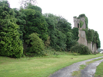 Timoney ParkCountry house · 429 yd
Explorer Tom Timoney Park is a ruined giant that Saint Patrick would have looked at and said, 'You’ve got some serious structural issues there, lad.' It stands imposingly on the road with crenellations and trefoil carvings, looking like it’s waiting for someone to finish the job or just accept it’s a fancy rock. It’s not exactly inviting you in, but it’s definitely holding its head high.
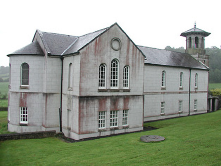 Christ Church (Corbally)Mill (water) · 1116 yd
Explorer Tom Christ Church in Corbally is having a dramatic standoff with the nearest tree, which keeps trying to claim its territory. It used to be a mill, so it still grinds out a bit of mystery every morning. Keep an eye on the former mill race; it’s the church’s way of flexing its old industrial muscles.
Black HillMountain / peak · 1.5 miExplorer Tom Black Hill in County Tipperary was once tried to be bought by a cow who thought it had very good grazing potential. The deal fell through because the cow kept trying to eat the contract documents. It's the kind of place that makes a dull Tuesday interesting.
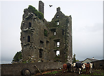 Castle (in Ruins)Castle, tower house · 1.8 mi
Explorer Tom Castle in Garranmaconly is gone, but the matchmaker who worked there still sends letters to no one. Four storeys of history now just sit politely on a rock. Bring wellies and low expectations, leave delighted.
 European Beech2.6 mi
Explorer Tom European Beech in County Tipperary was nearly sold off as a horse once, which is a bit of a stretch for anyone who has seen the thing. It just stands there looking dignified, like it knows exactly how ridiculous that story actually is. Stop the car, it's worth the hazard lights.
 CrossCross, High cross · 2.6 mi
Explorer Tom Cross in Monaincha started because two lads made a bet in the pub about who could carve better horses. One of them probably still owes the other a pint for losing. Look for the ghost, then pretend you didn't.
 European Yew3.0 mi
Explorer Tom European Yew in County Tipperary took about forty cups of tea to build its current level of smugness, and it shows every single time you look at it. It has the perfect amount of attitude to make you feel small without trying too hard. Bring biscuits, every good story needs biscuits.
 Ballaghmore CastleCastle, tower house · 3.4 mi
Explorer Tom Ballaghmore Castle has been hiding a scandal since the sixteenth century that involves Cromwell taking a sledgehammer to its pride and dignity, leaving it looking slightly embarrassed and very well-preserved. It’s basically a tower house that got a makeover in the nineteenth century just to hide the evidence. Go back in winter, it's a different animal.
Saint Kieran's WellSpring · 3.9 miExplorer Tom Saint Kieran’s Well is proud of being named after a guy whose name sounds like a sneeze, and honestly I can see why that’s worth celebrating. It really thinks its water quality is top-notch, but I’ve seen better hydration in my own garden hose. Bring a friend who talks too much and let the place shut them up.
Roscrea Petty Sessions HouseHeritage attraction · 4.1 miExplorer Tom Roscrea Petty Sessions House would get 'I heard everything' on its tombstone, because that’s all it ever did for years. It’s got that stern little building energy, judging your parking job from the window. Go in good boots and better humour to survive the stare.
 Round Tower4.2 mi
Explorer Tom This round tower claims to be older than time itself, which is total nonsense but fun. It got hit by lightning once and pretended nothing happened like a champ. Ring your granny and tell her exactly where you are standing now.
Millennium GardenMemorial · 4.4 miExplorer Tom Millennium Garden Memorial in County Tipperary is haunted by a ghost who is far too lazy to actually haunt anyone properly. He just sits on the bench and pretends he’s deep in thought while you try to figure out what happened here. Pretend it's yours and plan the housewarming.
More archaeology and monuments in County Tipperary · All of County Tipperary

What do you know about this place?Tap to add a comment or ask a question