What is recorded here
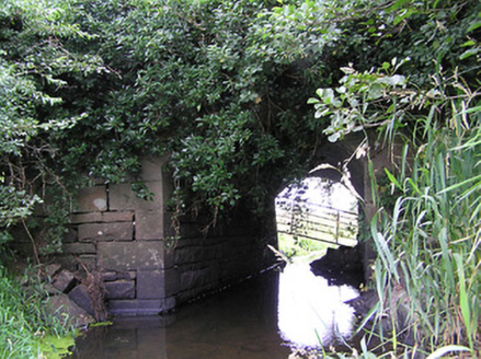
Drumury Bridge stands over an unnamed stretch of water connecting Beaghmore Lough and Gulladoo Lough. Both lakes got names, the bridge got a name, and the bit doing all the connecting was left answering to ‘you there’.
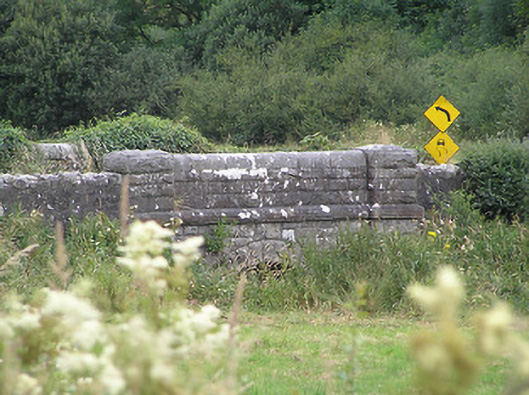
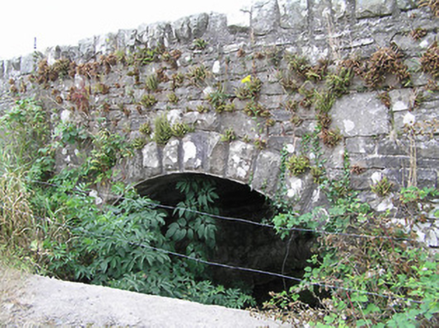
Single-arch road bridge, built c. 1860, over unnamed river/stream linking Beaghmore Lough (to the west) and Gulladoo Lough (to the east). Constructed of coursed rock-faced limestone with rounded dressed limestone coping over parapet walls. Segmental-headed arch with rock-faced limestone voussoirs. Rock-faced string course at road level. Terminating piers having rock-faced coping over. Short sections of rubble stone walling to either end of parapet walls (east and west). Located to the extreme north of County Longford, on the border with County Leitrim.
A robustly-built small-scale bridge, of mid nineteenth-century appearance, which is a pleasing feature in the rural landscape to the extreme north end of County Longford. The rustication to the piers and string course is finished with a straight edge to the corners, enhancing and emphasising the formal properties of the structure. The good quality heavily rock-faced masonry is a typical feature of the many bridges built throughout Ireland by the Board of Works during the mid-to-late nineteenth century, and particularly between c. 1847 - 60, suggesting that they may have been responsible for its construction. This bridge is similar in form to a number of other bridges in the area, including a bridge at Drumhalry (13400307), which suggests that it was built as part of a general drainage and/or bridge building programme. The present structure replaced an earlier bridge at this site (Ordnance Survey first edition six-inch map 1838).
From the Buildings of Ireland (National Inventory of Architectural Heritage) record 13400101
This does not grant access. Most recorded buildings are privately owned; view them only from public ground unless the owner allows entry.
Places near here
 bridge1424 ydCornaferstMountain / peak · 1482 yd
 bridge1681 ydFairy fort / earthen ringfort in FihoraghFairy fort / earthen ringfort · 1.0 miSt. Patricks WellHoly well · 1.3 miDrumbreanlisMountain / peak · 1.9 mi
 European Yew2.2 miNorth Midland Transport CollectionMuseum · 2.9 miKing's GraveArchaeological place · 3.3 miCastleBawn · 4.1 mi
 Pedunculate Oak4.6 miBawn in CastlepolesBawn · 4.7 mi
Pictures: National Inventory of Architectural Heritage; Sitomon, Wikimedia Commons · CC BY-SA 2.0; Algirdas at Lithuanian Wikipedia, Wikimedia Commons · Public domain
More historic places in County Longford · All of County Longford
What do you know about this place?