DDiscover AloneMapAbout

Cross in Carpenterstown

Cross, Wayside cross

The monument record does not grant public access. Check the route and ask the landowner before entering private land.

What survives
Recorded monument
What do you know about this place?Tap to add a comment or ask a question

What you write will be public.

What is recorded here

Drawn by Du Noyer (George Victor Du Noyer, “Calvary cross. On road side near Temple fanurn Co. W Meath. Sheet 3/4,” Royal Society of Antiquaries of Ireland, accessed January 24, 2020, http://rsai.locloudhosting.net/items/show/23471.) in the 19th century and described in 1928 as 'The central portion of the head of a…

Read the whole record
Drawn by Du Noyer (George Victor Du Noyer, “Calvary cross. On road side near Temple fanurn Co. W Meath. Sheet 3/4,” Royal Society of Antiquaries of Ireland, accessed January 24, 2020, http://rsai.locloudhosting.net/items/show/23471.) in the 19th century and described in 1928 as 'The central portion of the head of a cross with a solid ring 1ft. 1in. (0.32m) in diameter. On it are the letters I H S in relief and the remains of an inscription in four lines of five letters each. It is placed on the socket stone on the roadside near the National School, two miles N of Fore' (Crawford 1928, 58-9, no. 7). Recorded in 1976 as 'Located beside the roadway (E side) is a small limestone cross very weathered and worn. Only the head and upper portion of the shaft remains, one arm of the cross is gone. The cross is set in a large limestone socketed base of roughly square shape. The socket itself is a roughly neat shape but is too large for the upper portion of the shaft , the shaft was therefore of a tapered form. The mongram I H S and an inscription in raised lettering in English on one side of the cross head. Some of the letters can be read but it is difficult to make any full sense of it. Some of the letters on the right side especially are missing' (SMR file). Described in 1980 as 'The head and part of the shaft of a small solid ring cross (H 0.49m; Wth 0.34m; T 0.1m) with a large socketed base. The shaft has broken and the lower part of it is missing. The cross is quite damaged and only the remains of 2 arms can still be seen. On one face there is an inscription in capital letters and rather difficult to decipher. Possibly reads I H S (O)RA PRO A(N)/ (I)MA IOAN/ REL…/NN?. The other face is plain. The base is a large shaped rectangular block (dims. 0.54m x 0.53m), only roughly shaped with a deep rectangular socket (dims. 0.3m x 0.19m) cut in its upper edge. The cross is on the roadside, on E side of road' (SMR file). A sketch of the inscription shows the date 1650 near the base of the head of the cross (SMR file). A chapel indicated as 'Templefanum' (WM003-075----) is located 90m to the N. Compiled by: Caimin O'Brien Date of upload: 23 June 2010

From the National Monuments Service (Archaeological Survey of Ireland) record WM003-076

Places near here

Photo credits
  • National Inventory of Architectural Heritage
  • Illustrator not named; The Dublin Penny Journal (1835), public scan from Internet Archive and JSTOR, Wikimedia Commons · Public domain
  • Willow, Wikimedia Commons · CC BY 2.5
  • Marathon, Wikimedia Commons · CC BY-SA 2.0
  • Malene Thyssen, Wikimedia Commons · CC BY-SA 3.0
  • Oliver Dixon, Wikimedia Commons · CC BY-SA 2.0
  • Britishfinance, Wikimedia Commons · CC BY-SA 4.0
  • Mike Searle, Geograph · CC BY-SA 2.0
Hilltop enclosure in CarpenterstownHilltop enclosure · 661 yd

Explorer Tom Hilltop enclosure in Carpenterstown has caught my eye in Carpenterstown, County Westmeath. I bet a hilltop enclosure with a name like that could keep me talking all afternoon; I'm already inventing a daft little scene for it, and I'll stop before it turns into history.

handball alley1231 yd

Explorer Tom Handball alley in Templanstown has caught my eye in TEMPLANSTOWN (Faughalstown ED), County Westmeath. I bet a handball alley with a name like that could keep me talking all afternoon; I'm already inventing a daft little scene for it, and I'll stop before it turns into history.

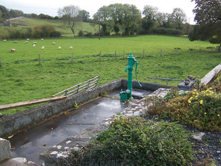
water pump1323 yd

Explorer Tom Water pump in Hilltown has caught my eye in Hilltown, County Westmeath. I bet a water pump with a name like that could keep me talking all afternoon; I'm already inventing a daft little scene for it, and I'll stop before it turns into history.

Hilltown Castle (in ruins)Castle, tower house · 1.3 mi

Explorer Tom Hilltown Castle has caught my eye in Hilltown, County Westmeath. I bet a castle, tower house with a name like that could keep me talking all afternoon; I'm already inventing a daft little scene for it, and I'll stop before it turns into history.

Fore AbbeyHeritage attraction · 1.7 mi

Explorer Tom Fore Abbey has caught my eye in County Westmeath. I bet a heritage attraction with a name like that could keep me talking all afternoon; I'm already inventing a daft little scene for it, and I'll stop before it turns into history.

European ash1.8 mi

Explorer Tom European ash has caught my eye in County Westmeath. I bet a european ash with a name like that could keep me talking all afternoon; I'm already inventing a daft little scene for it, and I'll stop before it turns into history.

Font in ForeFont · 1.9 mi

Explorer Tom Font in Fore has caught my eye in Fore, County Westmeath. I bet a font with a name like that could keep me talking all afternoon; I'm already inventing a daft little scene for it, and I'll stop before it turns into history.

European Beech1.9 mi

Explorer Tom European Beech has caught my eye in County Meath. I bet a european beech with a name like that could keep me talking all afternoon; I'm already inventing a daft little scene for it, and I'll stop before it turns into history.

Ben of ForeMountain / peak · 2.1 mi

Explorer Tom Ben of Fore has caught my eye in County Westmeath. I bet a mountain / peak with a name like that could keep me talking all afternoon; I'm already inventing a daft little scene for it, and I'll stop before it turns into history.

Seafin HillMountain / peak · 3.0 mi

Explorer Tom Seafin Hill has caught my eye in County Meath. I bet a mountain / peak with a name like that could keep me talking all afternoon; I'm already inventing a daft little scene for it, and I'll stop before it turns into history.

Mullaghmeen ForestPicnic place · 3.1 mi

Explorer Tom Mullaghmeen Forest has caught my eye in County Westmeath. I bet a picnic place with a name like that could keep me talking all afternoon; I'm already inventing a daft little scene for it, and I'll stop before it turns into history.

MoatCastle, motte · 4.5 mi

Explorer Tom Moat has caught my eye in Loughcrew, County Meath. I bet a castle, motte with a name like that could keep me talking all afternoon; I'm already inventing a daft little scene for it, and I'll stop before it turns into history.

More archaeology and monuments in County Westmeath · All of County Westmeath

Add to this placeAdd a picture Add a detailed tip Add a story

Explore the map1,118,976 places to discover

Next place · or swipeHilltop enclosure in Carpenterstown