What is recorded here
Situated in the shallows on the NE shoreline of Rahans Lough (L c. 1km N-S; c. 80-160m E-W), which has a bulbous (dims c. 330-c. 400m) northern end. This is a small cairn (diam. 5m; H 0.2m over water) but the cairn extends below the water level (D 0.5-1m) c. 10m to the W and S. This is probably the small crannog described by Boylan (1967, 362-3) in 1954 as having timbers when a dug-out canoe was discovered in the lake. There were no structural timbers visible in 1983, but animal bones were present.
Situated in the shallows on the NE shoreline of Rahans Lough (L c. 1km N-S; c. 80-160m E-W), which has a bulbous (dims c. 330-c. 400m) northern end. This is a small cairn (diam. 5m; H 0.2m over water) but the cairn extends below the water level (D 0.5-1m) c. 10m to the W and S. This is probably the small crannog described by Boylan (1967, 362-3) in 1954 as having timbers when a dug-out canoe was discovered in the…
From the National Monuments Service (Archaeological Survey of Ireland) record MO034-011
The monument record does not grant public access. Check the route and ask the landowner before entering private land.
- What survives
- Recorded monument
Places near here
IndicatedCrannog · 119 yd lime kiln389 ydfarmyard complex841 ydBarleyhillMountain / peak · 1.7 miMonkey-puzzle2.6 miNatural Play AreaMemorial · 2.6 miIn Memory of Our DadMemorial · 2.7 miLagan castleCastle, tower house · 2.7 miDún a Rí Forest ParkForest · 2.7 miCastle ruinsCastle, unclassified · 2.8 miCabraMountain / peak · 2.8 miPortal tomb in ErveyPortal tomb · 5.0 mi
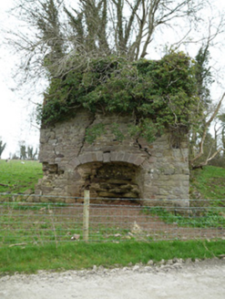 lime kiln389 yd
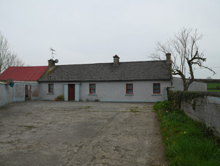 farmyard complex841 ydBarleyhillMountain / peak · 1.7 mi
 Monkey-puzzle2.6 miNatural Play AreaMemorial · 2.6 miIn Memory of Our DadMemorial · 2.7 miLagan castleCastle, tower house · 2.7 mi
 Dún a Rí Forest ParkForest · 2.7 miCastle ruinsCastle, unclassified · 2.8 miCabraMountain / peak · 2.8 mi
 Portal tomb in ErveyPortal tomb · 5.0 mi
Pictures: National Inventory of Architectural Heritage; Vicente Fernández Rioja, Wikimedia Commons · CC BY-SA 4.0; JP, Wikimedia Commons · CC BY-SA 2.0; Wanfried-Dublin, Wikimedia Commons · CC BY-SA 4.0
More archaeology and monuments in County Monaghan · All of County Monaghan
What do you know about this place?