What is recorded here
Extant remains comprise the ruins of portion of a four-storey house of late 18th or early 19th-century date, incorporating 17th-century stonework in NE angle, especially in the lower courses. This may have been the site of a castle built by Captain Gerald Fleming in 1607 and lost during the Williamite wars. Depicted on the Down Survey (1656-8) map as a large castle with two entrance gates at Cabragh (25) accompanied by a small building, perhaps a mill, on the bank of the E-W River Lagan c. 200m to the N. For the Down Survey map see this web-page accessed on 12/04/2016. http://downsurvey.tcd.ie/down-survey-maps.php#bm=Clanchie&c=Cavan There are no visible remains of a mill building.
Extant remains comprise the ruins of portion of a four-storey house of late 18th or early 19th-century date, incorporating 17th-century stonework in NE angle, especially in the lower courses. This may have been the site of a castle built by Captain Gerald Fleming in 1607 and lost during the Williamite wars. Depicted on the Down Survey (1656-8) map as a large castle with two entrance gates at Cabragh (25)…
From the National Monuments Service (Archaeological Survey of Ireland) record CV035-011
This remains an important historical record, but the official description says the monument is no longer visible or has been destroyed. The monument record does not grant public access. Check the route and ask the landowner before entering private land.
- What survives
- No visible remains or recorded as destroyed
Places near here
Ice HouseArchaeological place · 196 ydIn Memory of Our DadMemorial · 219 yd Horse-chestnut300 ydSarah BridgeBridge · 306 ydDún a Rí Forest ParkForest · 313 ydCabraMountain / peak · 607 ydCabra CastleDemesne walls/gates/railings · 889 ydBarleyhillMountain / peak · 1.6 miFair of MuffMemorial · 2.7 miFair of MuffVisitor information · 2.7 miCastle in ruinsCastle, unclassified · 2.8 miPortal tomb in ErveyPortal tomb · 2.9 mi
 Horse-chestnut300 yd
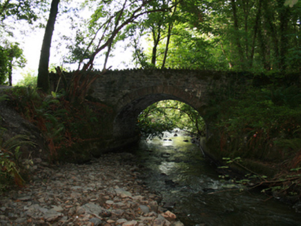 Sarah BridgeBridge · 306 yd
 Dún a Rí Forest ParkForest · 313 ydCabraMountain / peak · 607 yd
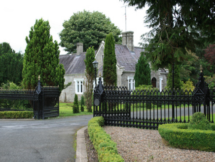 Cabra CastleDemesne walls/gates/railings · 889 ydBarleyhillMountain / peak · 1.6 mi
 Fair of MuffMemorial · 2.7 mi
 Fair of MuffVisitor information · 2.7 miCastle in ruinsCastle, unclassified · 2.8 mi
 Portal tomb in ErveyPortal tomb · 2.9 mi
Pictures: Stephan van Helden, Wikimedia Commons · CC BY-SA 4.0; National Inventory of Architectural Heritage; JP, Wikimedia Commons · CC BY-SA 2.0; Oliver Dixon, Geograph · CC BY-SA 2.0; Wanfried-Dublin, Wikimedia Commons · CC BY-SA 4.0
More castles and forts in County Cavan · All of County Cavan
What do you know about this place?