What is recorded here
Places near here
Photo credits
- milezero, Wikimedia Commons · CC BY-SA 2.0
- Sheila1988, Wikimedia Commons · CC BY-SA 4.0
- National Inventory of Architectural Heritage
- JP, Geograph · CC BY-SA 2.0
- Maker not stated on source page, fi.pinterest.com
- Maker not stated on source page, www.thejournal.ie
- Maker not stated on source page, www.flickr.com
- Maker not stated on source page, en.wikipedia.org
 RoadRoad, class 1 togher · 584 yd
Explorer Tom The big Road in Corlea was built with massive oak planks, like a proper ancient highway for giants. I reckon its…
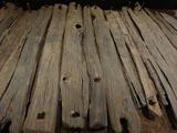 Corlea Trackway Interpretative CentreHeritage attraction · 597 yd
Explorer Tom Corlea Trackway Interpretative Centre in Longford is where a famous poet once fell into a ditch and wrote an epic about…
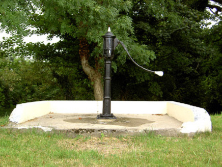 water pump1178 yd
Explorer Tom Water pump in Corlea in County Longford took about three million cups of tea to build, or so the legend goes. It’s…
 canal overflow1656 yd
Explorer Tom Canal overflow in Mosstown in County Longford is where a priest once lost a bet and had to walk home barefoot. It’s…
 Mosstown HarbourHarbour/dock/port · 1753 yd
Explorer Tom Mosstown Harbour started because two lads bet they could build a canal stop with just rocks and luck. Now it’s…
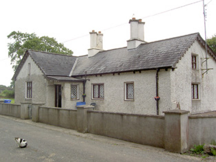 Mosstown HouseGate lodge · 1.0 mi
Explorer Tom Mosstown House in Mosstown is a Tudor-Revival gate lodge that thinks it’s from the 1500s. A hero probably saved it from…
 mill (water)1.1 mi
Explorer Tom Mill in Mosstown is stuck in a fairy dispute over parking rights near the old millponds. It’s a massive derelict…
 Cloonbreany BridgeBridge · 1.1 mi
Explorer Tom Cloonbreany Bridge has a tall tale that there’s a hidden tunnel under it leading straight to the local pub, which is…
 Standing stone in Mosstown (rathcline By.)Standing stone · 1.1 mi
Explorer Tom Standing stone in Mosstown is playing a game of peekaboo that’s got me losing my mind. It was on the old maps but…
 Fairy fort / earthen ringfort in Greenhall UpperFairy fort / earthen ringfort · 4.4 mi
Explorer Tom Fairy fort / earthen ringfort in Greenhall Upper claims a secret tunnel leads straight to the local pub. Nobody…
 CastleCastle, unclassified · 5.7 mi
Explorer Tom Castle in Collum has a curse that only affects people who don’t wave hello as they pass by on the road. It overlooks…
 Cloonbonny CemeteryCemetery · 6.4 mi
Explorer Tom Cloonbonny Cemetery has changed its name so many times it’s got identity issues and a legal bill to match. It keeps…
More walking routes in County Longford · All of County Longford

What do you know about this place?Tap to add a comment or ask a question