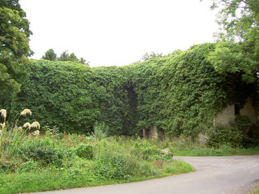
What is recorded here
Detached multiple-bay four-storey former flour mill on L-shaped plan, built c. 1800, now disused. Roof now collapsed. Roughcast rendered roughly coursed limestone walls. Square-headed window openings with tooled cut limestone sills. Square-headed door openings. Machinery now removed. Set at a bend in the road at the…
Read the whole record
From the Buildings of Ireland (National Inventory of Architectural Heritage) record 13313004
Places near here
Photo credits
- Maker not stated on source page, fi.pinterest.com
- National Inventory of Architectural Heritage
- Royalcanalrunner, Wikimedia Commons · CC BY-SA 4.0
- JP, Geograph · CC BY-SA 2.0
- Kmcnamee, Wikimedia Commons · CC BY-SA 4.0
- Maker not stated on source page, it.pinterest.com
- Maker not stated on source page, uk.pinterest.com
- Maker not stated on source page, www.findagrave.com
 Standing stone in Mosstown (rathcline By.)Standing stone · 255 yd
Explorer Tom Standing stone in Mosstown is playing a game of peekaboo that’s got me losing my mind. It was on the old maps but…
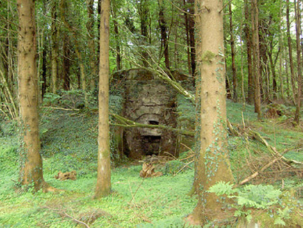 kiln324 yd
Explorer Tom Kiln in Mosstown would describe the 1800s to a teenager as 'basically a giant oven for rocks.' This lime kiln is…
 gates/railings/walls387 yd
Explorer Tom Gates in Mosstown are the remains of a deer park, so imagine angry stags charging through while you’re trying to look…
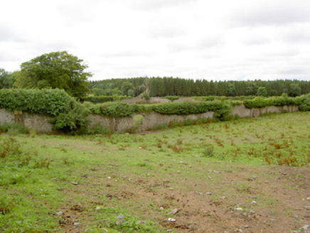 Mosstown HouseWalled garden · 475 yd
Explorer Tom Mosstown House in Mosstown is all walls and no house now, which is weirdly liberating. The Tudor doors are still…
 41st LockLock · 559 yd
Explorer Tom 41st Lock tells its replacement that it looks cheap, like a plastic toy compared to this limestone masterpiece. It’s…
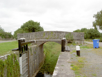 Coolnahinch BridgeBridge · 577 yd
Explorer Tom Coolnahinch Bridge in County Longford was built by an engineer who was definitely thinking about his next cup of tea.…
 canal overflow651 yd
Explorer Tom Canal overflow in Mosstown in County Longford is where a priest once lost a bet and had to walk home barefoot. It’s…
 Mosstown HarbourHarbour/dock/port · 880 yd
Explorer Tom Mosstown Harbour started because two lads bet they could build a canal stop with just rocks and luck. Now it’s…
 McGann Park, KenaghGAA ground · 1051 yd
 Ballyknock Castle (in Ruins)Castle, tower house · 1419 yd
Explorer Tom Ballyknock Castle is perched on a hillock like it’s trying to get a better signal on its ancient satellite dish. It…
 Fairy fort / earthen ringfort in Stonepark (moydow By.)Fairy fort / earthen ringfort · 1681 yd
Explorer Tom A local in Stonepark claims he invented this fort himself using a shovel and pure confidence. It is barely visible now…
 Mapped graveyardGraveyard · 1.0 mi
Explorer Tom Mapped graveyard in County Longford gave up eating fresh flowers for Lent because it found them too distracting. It’s…
More historic places in County Longford · All of County Longford

What do you know about this place?Tap to add a comment or ask a question