DDiscover AloneMapAbout

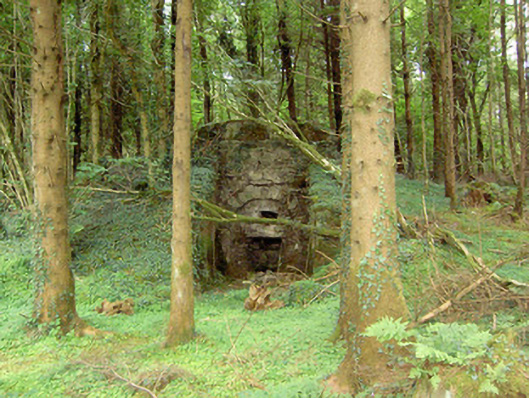
Kiln in Mosstown

Kiln
Kiln in Mosstown
Photo: National Inventory of Architectural Heritage · Report the wrong picture

What is recorded here

Freestanding single-bay lime kiln, built c. 1820, on a square-plan with splayed projecting walls to the front (north). Now out of use. Constructed of coursed limestone rubble. Segmental-headed arch to front (north), the former oven aperture, with dressed limestone voussoirs and cut stone lintel. Former loading bay to…

Read the whole record
Freestanding single-bay lime kiln, built c. 1820, on a square-plan with splayed projecting walls to the front (north). Now out of use. Constructed of coursed limestone rubble. Segmental-headed arch to front (north), the former oven aperture, with dressed limestone voussoirs and cut stone lintel. Former loading bay to top of kiln, now overgrown. Earth embankment to rear (south). Sited alongside a track within the Old Deer Park, north of Mosstown Demesne walls (13313009). Located to the northwest of Keenagh.
The interesting survival of a former lime kiln, probably built in the early-nineteenth century, which is of technical merit. It is well-built using local limestone and is an appealing and unassuming element of the agricultural/industrial and social heritage of County Longford. The embankment to the rear was built to allow for the easy loading of limestone through an opening in the roof structure. Lime kilns appear to have come into popular use in Ireland during the eighteenth century and were once quite a common feature in the rural landscape. They were used to burn limestone to produce lime, which was used in construction/building as a mortar and a render, or to produce a fertilizer, which was then spread on agricultural land. Lime was also used for lime-washing buildings, particularly farm buildings, as it was regarded as a cleansing agent at the time. Small rural lime kilns started to go out of common usage during the late nineteenth-century with the advent of industrial-scale lime production facilities and improvements in the transport network, particularly the development of the railways.

From the Buildings of Ireland (National Inventory of Architectural Heritage) record 13313007

This does not grant access. Most recorded buildings are privately owned; view them only from public ground unless the owner allows entry.

What do you know about this place?Tap to add a comment or ask a question

What you write will be public.

Places near here

Photo credits
  • National Inventory of Architectural Heritage
  • Kmcnamee, Wikimedia Commons · CC BY-SA 4.0
  • Sheila1988, Wikimedia Commons · CC BY-SA 4.0
gates/railings/walls177 yd

Explorer Tom Gates in Mosstown are the remains of a deer park, so imagine angry stags charging through while you’re trying to look…
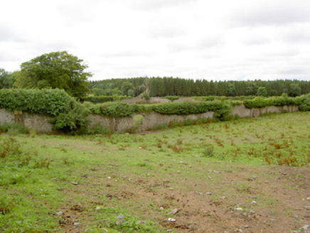
Mosstown HouseWalled garden · 288 yd

Explorer Tom Mosstown House in Mosstown is all walls and no house now, which is weirdly liberating. The Tudor doors are still…

CastleCastle, unclassified · 304 yd

Explorer Tom Castle in Mosstown had a bishop who refused to visit because he was busy doing something else. Now it’s basically…

McGann Park, KenaghGAA ground · 787 ydBawn in BallyknockBawn · 1376 yd

Explorer Tom Bawn in Ballyknock has a ghost that's too lazy to haunt it properly. It’s built right over an old ringfort, so it’s…

Church (Site of)Church · 1537 yd

Explorer Tom Church in Kilmakinlan is playing hide-and-seek with me. It’s just a pasture now, but I bet if it showed up at a…

StructureStructure, peatland · 1584 yd

Explorer Tom Structure in Coolnahinch has an imaginary twin across the sea who is much louder and wears sunglasses all day long.…

Corlea Bog Walk Canal BranchWalking route · 1.2 mi

Explorer Tom Corlea Bog Walk Canal Branch in County Longford is having a massive row with the road that leads to it. The canal…

Corlea Bog Walk Blue LoopWalking route · 1.2 mi

Explorer Tom Corlea Bog Walk Blue Loop in County Longford is where smugglers used to hide their whiskey inside hollow logs that were…
Corlea Trackway Interpretative CentreHeritage attraction · 1.2 mi

Explorer Tom Corlea Trackway Interpretative Centre in Longford is where a famous poet once fell into a ditch and wrote an epic about…

Graveyard in Curry (ardagh By., Coolamber Ed)Graveyard · 4.2 mi

Explorer Tom Graveyard in Curry would use a lotto win to buy more headstones for all those who haven't had one yet. It sits in level…

Dunbeggan, Young GrattansGAA ground · 4.6 mi

More historic places in County Longford · All of County Longford

Add to this placeAdd a picture Add a detailed tip Add a story

Explore the map1,095,414 places to discover

Next place · or swipegates/railings/walls