DDiscover AloneMapAbout

Church, Graveyard, County Offaly (OF004-013----)

Church

The monument record does not grant public access. Check the route and ask the landowner before entering private land.

Official monument number
OF004-013----
What do you know about this place?Tap to add a comment or ask a question

What you write will be public.

What is recorded here

Church built in 1686 according to an inscription on an armorial plaque (OF004-013005-) over the doorway by J. Wakely (Lewis 1837, 125) but was partly destroyed in 1972 and has since been levelled. There was a gothic latticed window in the E wall. Memorial slab in church dated 1617 with carved effigy of Capt Wakley…

Read the whole record
Church built in 1686 according to an inscription on an armorial plaque (OF004-013005-) over the doorway by J. Wakely (Lewis 1837, 125) but was partly destroyed in 1972 and has since been levelled. There was a gothic latticed window in the E wall. Memorial slab in church dated 1617 with carved effigy of Capt Wakley with his lance, sword and shield (JRSAI 1865 332-3) now in National Museum and grave-slab (OF004-013004-) which was in W wall said to be from Coolcor monastic site (OF004-011002-).(Irish Times 5/2/1975) Archaeological test-trenching was carried out by Claire Mullins under licence no. 97E0321 on 16 October 1997 at a site adjacent to the late medieval Ballyburley church and cemetery (OF004-013001-), near Rhode, Co. Offaly. Archaeological remains were uncovered during testing. These consisted of evidence of a ditch (OF004-013006-) that possibly originally encircled the ecclesiastical site and disturbed human remains on the cemetery side of this ditch (Excavations 1997, 147). Monitoring of groundworks associated with the development was carried out on various dates in February and June 1998. Foundations for the house were dug just north-east of the apparent line of the ditch, as identified during the evaluation of the site, and therefore did not transect the line of this feature. Levels were also reduced over a larger area surrounding the house, but the fact that no further evidence of the ditch was identified during this process may be due to the generally low visibility of many forms of archaeological remains. In the percolation trench on the northern corner of the site a considerable amount of generalised disturbance was observed at a depth that appeared to be slightly below the original level of the sterile natural in this area. Tiny fragments of charcoal, as well as a number of what appeared to be charred seeds, were also found within this disturbance. There was no obvious structural organisation to this material as it seemed to fill a series of irregular undulations in the surface of the natural, but the narrowness of the percolation trench served to inhibit any clear perspective of this material. No further human remains were found during monitoring. While no clearly identifiable archaeological features were discovered during the course of monitoring, it certainly appears that some archaeological material exists over the general area of the site, particularly in the northern and western sides. This suggests that the archaeologically sensitive area is not confined to the cemetery side of the ditch and that the general environs of the site are also of archaeological significance (Excavations Bulletin 1998).

From the National Monuments Service (Archaeological Survey of Ireland) record OF004-013

Places near here

Photo credits
  • Maker not stated on source page, en.wikipedia.org
  • Maker not stated on source page, www.pinterest.com
  • National Inventory of Architectural Heritage
  • Maker not stated on source page, www.flickr.com
  • Maker not stated on source page, ca.pinterest.com
  • Kmcnamee, Wikimedia Commons · CC BY-SA 4.0
  • Google / Tom McDermott, as credited by Midlands 103, www.midlands103.com
Church, GraveyardGraveyard · 5 yd

Explorer Tom Church, Graveyard in Ballyburly has been bulldozed flat since 1972, so it's basically a very expensive shadow now. It…

Ballyburly Old GraveyardGraveyard · 34 yd

Explorer Tom Ballyburly Old Graveyard in County Offaly is where the shortcut that isn’t a shortcut leads you to a dead end full of…

Standing stone in BallyburlyStanding stone · 559 yd

Explorer Tom Standing stone in Ballyburly is two metres of pure stubbornness, sitting on high ground with a view for days. It…
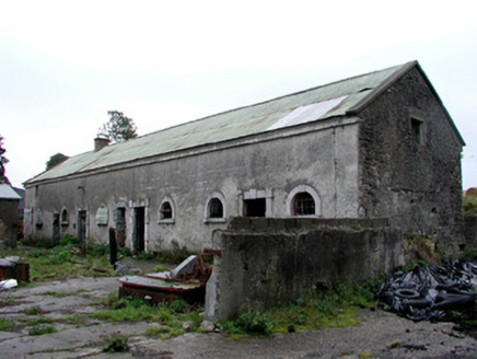
Greenhills HouseStables · 992 yd

Explorer Tom Greenhills House stables in Greenhills are no longer used by horses but still show off high-quality window and door…

CastleCastle, unclassified · 1019 yd

Explorer Tom Castle in Fahy is unlocated, which means it’s playing hard to get with the surveyors. It had a name back in 1838, but…
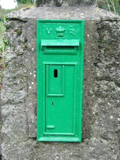
post box1092 yd

Explorer Tom Post box in Ballystrig rates every visitor one star unless you bring biscuits or at least a decent hat. It’s been…
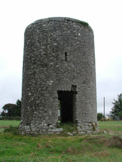
mill (wind)1424 yd

Explorer Tom The Mill in Fahy is getting picked on by the wind because it refuses to wear a hat. It stands proudly on a hill…
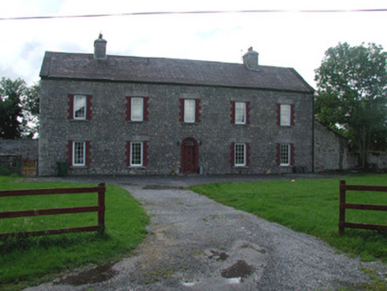
Dunville HouseHouse · 1517 yd

Explorer Tom Dunville House was built on a bargain deal that nobody else wanted, which is why it looks so smug. Its ashlar chimneys…
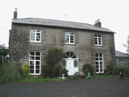
Coolville HouseHouse · 1.1 mi

Explorer Tom Coolville House is why map makers got it wrong, as they kept drawing it as two separate buildings and getting confused.…

Black Castle (in ruins)Castle, tower house · 1.4 mi

Explorer Tom Black Castle in Ballyheashill was nearly sold to a farmer for a horse. It has almost no windows, which saves on heating…

Clonmore Harps GAA pitchGAA ground · 1.5 miFr. Dowling Park, RhodeGAA ground · 2.1 mi

More historic places in County Offaly · All of County Offaly

Add to this placeAdd a picture Add a detailed tip Add a story

Explore the map1,095,414 places to discover

Next place · or swipeChurch, Graveyard