
What is recorded here
On a prominent rise of ground with good views of the surrounding countryside in all directions. A ringfort (LF014-056----) and moated site (LF014-051----) are 180m and 495m to the N respectively, a church (LF014-058001-) and graveyard (LF014-058002-) are 230m to the SSW and a motte and bailey (LF014-050) with a stone castle (LF014-050002-) are 580m to the NNW. Known locally as 'Charlton's Folly' which was an 18th century building built by Thomas Charlton that was never finished (Farrell 1891, 285-6). Present remains consist of the ruins of a rectangular, single pile house (ext. dims. 16.6m NE-SW, 9.6m NW-SE, Wall T 1.2m - 0.6m) orientated on a NE-SW axis, standing two storeys high with an attic and a partially sunken basement. The doorway is in the centre of the SE wall at ground floor level. The walls have no batter and are built with coursed limestone rubble, the tall rectangular windows with flat arches are 18th century in date and there is a semi-circular shaped tower projecting from the centre of the NE (ext. diam. c. 4.6m) gable. In 1836 the OS Field Name Books recorded that in this townland there were 'the ruins of two castles (LF014-051002-)' (OSFNB Parish of Clonbroney, Book no. 7, 139). This building is named 'castle' on all eds. of the OS 6-inch maps. The lower courses of the walls of the NE and SW gables measure c. 1.2m thick which narrow to 0.6m at ground floor level. This is the only evidence to suggest that there may have been an earlier building on this site. However, there is no break or change in the appearance of the masonry which suggests that the walls of thius building date from the 18th century. The internal walls of the building are lined with red brick as well as the joist holes for the wooden floors of the house. There is no evidence of any features dating from the 17th century and the building has all the appearance of dating from the 18th century. It is evident that this building was never finished and became known as 'Charlton's Folly', named after Thomas Charlton of Curratown, Co. Meath who died in 1792 (Nun 1801, 47).
Compiled by: Caimin O'Brien
Date of upload: 26 August 2011
The monument record does not grant public access. Check the route and ask the landowner before entering private land.
- What survives
- Recorded monument
Places near here
 Church (in Ruins)Church · 286 yd
 Ecclesiastical enclosure in MoatfarrellEcclesiastical enclosure · 288 yd
 IndicatedBawn · 578 yd
 Field system in MoatfarrellField system · 598 yd
 Moat & CastleCastle, motte and bailey · 641 yd
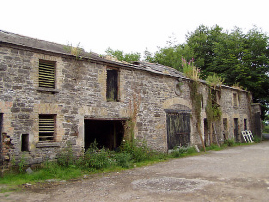 Moatfarrell Houseoutbuilding · 674 yd
 Edgeworthstown BypassMemorial · 2.4 mi
 Oldtown DemesneForest · 3.0 mi
 Oldtown CopseWood · 3.1 mi
 Clonfin Ambush MemorialMemorial · 3.4 mi
 Bully's Acregraveyard/cemetery, unknown · 3.7 mi
 Granard MotteMotte-and-bailey castle remains · 6.7 mi
Other information
Photo: Credit not shown in the picture search · Rights wording not checked; contact us if this picture should be removed