What is recorded here
Situated on a SE-facing slope between two streams in the upper Tay river valley. This is a grass-covered area of c. 4ha containing about twenty clearance cairns (diams. 2-5m; H 0.3-0.6m). It also contains the hut-site (WA014-056001-).
From the National Monuments Service (Archaeological Survey of Ireland) record WA014-056
The monument record does not grant public access. Check the route and ask the landowner before entering private land.
- What survives
- Recorded monument
Places near here
Photo credits
- kevin higgins, Geograph · CC BY-SA 2.0
- Rwxrwxrwx at English Wikipedia, Wikimedia Commons · Public domain
- Colin Park, Geograph · CC BY-SA 2.0
- National Inventory of Architectural Heritage
- Kevin O'Brien 13, Wikimedia Commons · CC BY-SA 4.0
Hut site in ComeraghHut site · 38 ydBurial in ComeraghmountainBurial · 284 ydMahon ValleyCliff · 1.2 mi Mahon ValleyCliff · 1.4 miSeefinMountain / peak · 1.6 miMahon FallsWaterfall · 1.6 miCoumfeaMountain / peak · 1.9 miCrough WoodWood · 2.0 miKilrossanty ChurchChurch/chapel · 2.3 miComeragh LodgeHouse · 2.3 miSite of CastleCastle, unclassified · 2.4 miCoumshingaunMountain corrie and lake · 3.1 mi
 Mahon ValleyCliff · 1.4 mi
 SeefinMountain / peak · 1.6 mi
 Mahon FallsWaterfall · 1.6 mi
 CoumfeaMountain / peak · 1.9 miCrough WoodWood · 2.0 mi
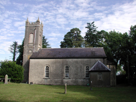 Kilrossanty ChurchChurch/chapel · 2.3 mi
 Comeragh LodgeHouse · 2.3 miSite of CastleCastle, unclassified · 2.4 mi
 CoumshingaunMountain corrie and lake · 3.1 mi
More archaeology and monuments in County Waterford · All of County Waterford
What do you know about this place?