What is recorded here
Situated in a hollow on the NE bank of the NW-SE Coumatay stream. In the early eighteenth century a General Blakeney became a recluse in the Monavullagh Mountains (Ryland 1824, 277-8). When he died he was buried with his dog and his gun at the side of the stream, at a location which is known locally. A line of stones (L 2m) with an attached line of stone (L 0.9m) running SW from its SE end, mark two sides of what is locally thought to be the grave.
Situated in a hollow on the NE bank of the NW-SE Coumatay stream. In the early eighteenth century a General Blakeney became a recluse in the Monavullagh Mountains (Ryland 1824, 277-8). When he died he was buried with his dog and his gun at the side of the stream, at a location which is known locally. A line of stones (L 2m) with an attached line of stone (L 0.9m) running SW from its SE end, mark two sides of what…
From the National Monuments Service (Archaeological Survey of Ireland) record WA014-066
The monument record does not grant public access. Check the route and ask the landowner before entering private land.
- What survives
- Recorded monument
Places near here
Photo credits
- kevin higgins, Geograph · CC BY-SA 2.0
- Rwxrwxrwx at English Wikipedia, Wikimedia Commons · Public domain
- Colin Park, Geograph · CC BY-SA 2.0
- National Inventory of Architectural Heritage
- Kevin O'Brien 13, Wikimedia Commons · CC BY-SA 4.0
Hut site in ComeraghHut site · 275 ydCairnfield in ComeraghmountainCairnfield · 284 ydMahon ValleyCliff · 1.0 mi Mahon ValleyCliff · 1.3 miMahon FallsWaterfall · 1.5 miSeefinMountain / peak · 1.6 miCoumfeaMountain / peak · 1.7 miCrough WoodWood · 2.0 miComeragh LodgeHouse · 2.4 miSite of CastleCastle, unclassified · 2.4 miKilrossanty ChurchChurch/chapel · 2.4 miCoumshingaunMountain corrie and lake · 3.0 mi
 Mahon ValleyCliff · 1.3 mi
 Mahon FallsWaterfall · 1.5 mi
 SeefinMountain / peak · 1.6 mi
 CoumfeaMountain / peak · 1.7 miCrough WoodWood · 2.0 mi
 Comeragh LodgeHouse · 2.4 miSite of CastleCastle, unclassified · 2.4 mi
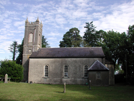 Kilrossanty ChurchChurch/chapel · 2.4 mi
 CoumshingaunMountain corrie and lake · 3.0 mi
More archaeology and monuments in County Waterford · All of County Waterford
What do you know about this place?