DDiscover AloneMapAbout

Burial ground in Augherskea

Burial ground
Computer-made picture that does not show Burial ground in AugherskeaNot a photo of this monument
Computer-made picture. It does not show this monument. · Report the wrong picture

The monument record does not grant public access. Check the route and ask the landowner before entering private land.

What do you know about this place?Tap to add a comment or ask a question

What you write will be public.

What is recorded here

The monument (1A/23/1) was partially excavated (02E1229) after pipe trench insertion had truncated it. Complementing the excavation, a geophysical survey (Licence no. 02R 143) and a detection device programme (Licence no. 02R 133) of the surrounding area were carried out. The site is situated on the lowest terrace…

Read the whole record
The monument (1A/23/1) was partially excavated (02E1229) after pipe trench insertion had truncated it. Complementing the excavation, a geophysical survey (Licence no. 02R 143) and a detection device programme (Licence no. 02R 133) of the surrounding area were carried out. The site is situated on the lowest terrace (along the 90m contour line) of the south-facing slopes of the valley of the Derrypatrick River. The excavation was characterised by three major elements, the burial ground, abutted by agricultural features to the east and evidence for habitation to the west. The burial ground was delineated by ditches had a maximum EW dimension of c.63m. The earliest feature on site was a NS V-shaped linear ditch cut into natural subsoil. Radicarbon dating of a charcoal sample resulted in a date range of 660-870 AD (1280+/- 40BP). It contained a total of 16 burials. Inclusions of charcoal, shell, and animal bone and the presence of oat, barley, indeterminate cereal grains, weeds and hazelnut shells and two fragments of smithing hearth bottoms were recorded. A total of 187 burials were excavated, the substantial majority (40%) of which can be aged to the 36-45 year and over 46 years categories. A total of four burials had been subject to weapons trauma. Two males were decapitated and a further two the victims of attempted decapitation. Two of these males were buried in a double grave with an intrusive neonate. Another had suffered a series of blows to the head from an axe and post mortem mutilation with a sharp knife. Agricultural deposition (22.50m EW xy 5m) to the east of the burial ground was characterised by a series of drainage ditches and gullies cut by cultivation furrows. Radiocarbon analysis dated the furrows to the period 890-1160 A.D. Habitation evidence to the west of the burial ground comprised a series of ditches, gullies and pits. At least three smithing hearth bottoms, smithing slag and charcoal as fuel were recovered. A series of intercutting pits of indeterminate function were excavated. A sub-rectangular circular pit (3m diam. 2.4m deep) produced a radiocarbon date of between 760 -980 A.D. This date range was corroborated by dendrochronological analysis of wood taken from the fill which had a felling date of late 836 A.D. or early 837 A.D. The organic nature of the basal fills suggested cesspit material. Plant analysis identified including blackberry/bramble, hemp-nettle, cabbage/turnip/mustard, mint and pink seeds. A range of artefacts recovered included fragments of lignite bracelet, blades of whittle tang knives, a socketed gouge, a bone pin and a composite fragment of a D2 double sided bone comb. (Baker 2004; 2007; 2010) Compiled by: Christine Baker

From the National Monuments Service (Archaeological Survey of Ireland) record ME043-049

Places near here

Photo credits
  • National Inventory of Architectural Heritage
  • Maker not stated on source page, en.wikipedia.org
  • Maker not stated on source page, commons.wikimedia.org
  • Maker not stated on source page, www.pinterest.com
  • Kmcnamee, Wikimedia Commons · CC BY-SA 4.0
  • Tim Wilson, Geograph · CC BY-SA 2.0
  • Maker not stated on source page, www.irishamericanmom.com
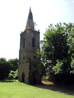
Knockmark ChurchChurch/chapel · 1.0 mi

Explorer Tom Knockmark Church is basically just a tower standing there after the main building got demolished, which is like losing…

Church (in Ruins)Church · 1.0 mi

Explorer Tom Church in Knockmark has a pigeon who refuses to leave. He’s seen more history than most historians, and he’s not…

Mapped graveyardGraveyard · 1.0 mi

Explorer Tom Mapped graveyard in County Meath would win the county fair just by standing still and looking dignified while everyone…
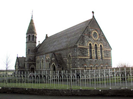
Catholic Church of Saint Martin of ToursChurch/chapel · 1.3 mi

Explorer Tom Catholic Church of Saint Martin of Tours has polychromy that makes your eyes dance like it’s a disco. A cow once tried…

Stone head in Warrenstown (deece Lower By.)Stone head · 1.3 mi

Explorer Tom Stone head in Warrenstown was part of a bargain to build a well, and these two heads are still set into the ground like…

water pump1.4 mi

Explorer Tom Water pump in Knockmark has decorative banding that makes it look like a piece of art rather than a water source. It…

Drumree GAAGAA ground · 1.4 mipost box1.6 mi

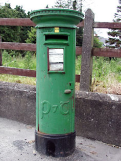
Explorer Tom Post box in Knockmark is written in traditional Irish lettering, which makes it feel like a tiny monument to…
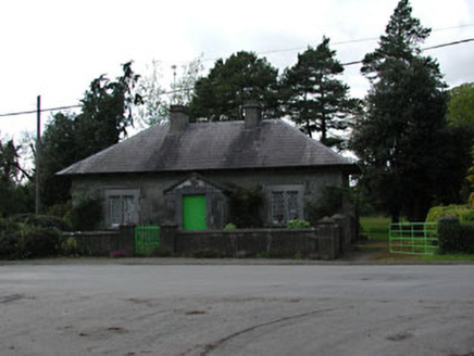
worker's house1.9 mi

Explorer Tom Worker's house in Dunsany refuses to fall down because it’s too stubborn, holding onto its slate roof and sash windows…

Dunsany CastleCastle, unclassified · 1.9 mi

Explorer Tom Dunsany Castle in Dunsany is sick of people asking if it’s haunted when it’s just lonely. It’s been standing there…

Fairy fort / earthen ringfort in ArodstownFairy fort / earthen ringfort · 2.1 mi

Explorer Tom Arodstown Fairy Fort would have 'Finally Found' on its tombstone after centuries of being misidentified as a pile of…

Kiltale GAAGAA ground · 2.1 mi

More archaeology and monuments in County Meath · All of County Meath

Add to this placeAdd a picture Add a detailed tip Add a story

Explore the map1,095,414 places to discover

Next place · or swipeKnockmark Church