DDiscover AloneMapAbout

Blockhouse Battery

Blockhouse

The monument record does not grant public access. Check the route and ask the landowner before entering private land.

What do you know about this place?Tap to add a comment or ask a question

What you write will be public.

What is recorded here

At the NE tip of Castlepark promontory in Kinsale harbour. The remains of this blockhouse are approached from the W by a covered way from James' Fort (CO112-036---). It was built on a rock outcrop just above the high-tide mark. According to O'Neil (1940, 113), the earliest part of the structure dates to the 16th…

Read the whole record
At the NE tip of Castlepark promontory in Kinsale harbour. The remains of this blockhouse are approached from the W by a covered way from James' Fort (CO112-036---). It was built on a rock outcrop just above the high-tide mark. According to O'Neil (1940, 113), the earliest part of the structure dates to the 16th century, however, O'Sullivan (1916, 99) gives a 1604 account for the construction of James Fort which includes £50 for a 'Blockhouse at the point of the land'. It is shown on a 1625 map (Hayes-McCoy 1964, 33) and clearly depicted in Phillips's 'prospect' of 1685 (Kerrigan 1977-9). Whatever its date, the structure appears to be the remains of a shore-level battery of at least eight guns, with a magazine and accommodation as part of the complex. The remains consist of a roofless ruin, modified in recent times when it was used as a 'store for fish boxes' (O'Sullivan 1916, 100). The covered way leads to a downward sloping ramp passing between two rectangular structures and through wide doorway onto the level platform (17.8m E-W; 17m N-S), enclosed by straight walls to the N, S and W and by a three-sided wall to the E. The ground floor wall is pierced by a series of double splayed opes, all modified recently to take window frames; the 1st floor wall was added in recent times. The double splayed opes are probably gun ports. In the NW corner a passage leads to a domed magazine (6.1m E-W; 4.6m N-S), approached through a small ante chamber. In the N wall of the passage there is a splayed and lintelled ope with a narrow vertical slit, and according to O'Neil (1940, 112) it is 'probable that this opening is for cannon' and was dated by him to the 16th century. In the SW corner a rock-cut passage with rock-cut stairs rises to a platform (c. 4m E-W; c. 3.5m N-S) overlooking the buildings. On the N side of the ramp is a 2-storey structure (int. 3.45m N-S; 3.6m E-W) with a fireplace in the W wall on both floors, and gun loops in the N and S walls at 1st floor level. To the S of the ramp there is a similar structure with one floor, at a higher level, also with a fireplace in the W wall. Overlooking the blockhouse, c. 80m to the WSW is a rectangular gable-ended structure (7.3m N-S; 10.5m E-W), roofless but with walls standing to full height, partially ivy-clad on inspection. It has a central door in the E wall, approached through a round-arched porch, flanked by windows with attic window overhead; the side walls are blank. A central fireplace in the W wall is covered by a segmental brick arch, and a rectangular stack overhead; unusually, four angled flues feed into the stack but the features from which they fed are gone or ruined. Kerrigan (1980, 15) suggests it may be the remains of a tower built in 1654-6 and shown on Phillips's 'prospect' of 1685, however, it is depicted on the prospect as a tall square tower unlike the present structure. The arrangement of flues suggests some system for smoking fish; according to local information it was used for curing fish (pers. comm. Eugene Gillen). This is a National Monuments in State Guardianship (no. 525). Photographs attached CO112-083----_01: View of blockhouse from SE. CO112-083----_02: Interior of the blockhouse from S. Date of upload/revision: 14 January 2009

From the National Monuments Service (Archaeological Survey of Ireland) record CO112-083

Places near here

Photo credits
  • National Inventory of Architectural Heritage
  • Maker not stated on source page, in.pinterest.com
  • Picture: The Boathouse Gallery
  • Christopher Michel, Wikimedia Commons
  • Andy Beecroft, Geograph · CC BY-SA 2.0
  • Garry Dickinson, Geograph · CC BY-SA 2.0
  • Mike Searle, Wikimedia Commons · CC BY-SA 2.0
O'Flaherty HouseHouse · 466 yd

Explorer Tom O'Flaherty House in Ardbrack is a modern minimalist masterpiece on pilotis, which makes it look like it’s floating…

Creagh CottageHouse · 606 yd

Explorer Tom Creagh Cottage in Ardbrack is small but mighty, built around 1820. It’s got slate hanging on the front which looks like…
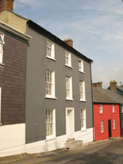
Summer Cove HouseHouse · 609 yd

Explorer Tom Summer Cove House would survive a reality show by just sitting there, judging everyone’s terrible cooking from its…
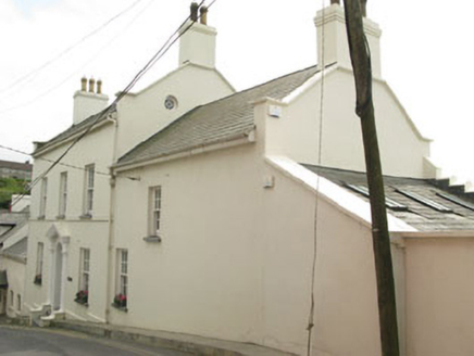
DuncarrigHouse · 630 yd

Explorer Tom Duncarrig in Ardbrack is a show-off with a plain front but an absolutely massive rear elevation facing the sea. It…
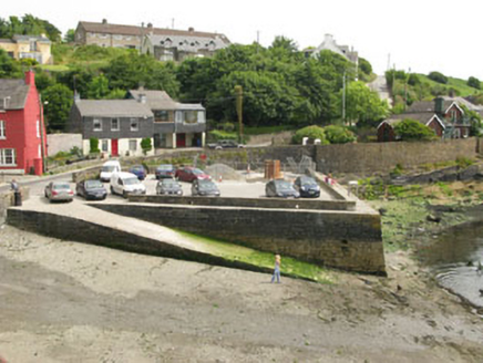
quay/wharf656 yd

Explorer Tom Quay or wharf in Ardbrack is right next to Charles Fort, which makes it feel really important. It’s been singing…
post box658 yd

Explorer Tom Post box in Ardbrack is covered in Gaelic script that probably sounds like a fiddle playing all night. It’s simple…

Saint Eltin's CemeteryCemetery · 1211 yd

Explorer Tom Saint Eltin's Cemetery would tell the interviewer it has excellent people skills because it listens to everyone without…

The Boathouse GalleryGallery · 1312 yd

Explorer Tom At 68 Main Street in Kinsale, the Boathouse Gallery has pulled off a tidy trick: a building erected as a steam bakery…

KinsaleHistoric town · 1331 yd

Explorer Tom You might call Kinsale picturesque. The harbour once called it strategic. Kinsale is a town built around a harbour that…

Kinsale HarbourBay · 1450 yd

Explorer Tom Kinsale Harbour is hiding a secret message in its stones, allegedly written by a fisherman who got fed up of waiting…

Ringrone Castle (in Ruins)Castle, tower house · 1.1 mi

Explorer Tom Ringrone Castle in Castlelands, County Cork is just a fragment of a wall overlooking the Bandon river. Built by the de…

Ringrone CastleCastle · 1.1 mi

Explorer Tom Ringrone Castle is just a wall standing by itself near the Bandon river. Myles De Courcey built it in 1225, and the…

More archaeology and monuments in County Cork · All of County Cork

Add to this placeAdd a picture Add a detailed tip Add a story

Explore the map1,095,414 places to discover

Next place · or swipeO'Flaherty House