
What is recorded here
At the E edge of a rocky hillock in undulating grassland. Named ‘Toberlauva’ on the 1838 and 1915 editions of the OS 6-inch maps. On inspection in August 1991 this spring well was surrounded by a U-shaped drystone wall (c. 0.9m N-S; c. 0.8m E-W), which was set flush with ground surface and opened to the E. A number of…
Read the whole record
From the National Monuments Service (Archaeological Survey of Ireland) record GA128-042
Places near here
Photo credits
- Kmcnamee, Wikimedia Commons · CC BY-SA 4.0
- National Inventory of Architectural Heritage
- John M, Geograph · CC BY-SA 2.0
- Maker not stated on source page, www.dreamstime.com
- Mike Searle, Wikimedia Commons · CC BY-SA 2.0
- Maker not stated on source page, en.wikipedia.org
- Maker not stated on source page, ca.pinterest.com
- National Library of Ireland on The Commons, Wikimedia Commons · No restrictions
- Maker not stated on source page, imgur.com
- Maker not stated on source page, www.irelandhighlights.com
 Beagh GAAGAA ground · 214 yd
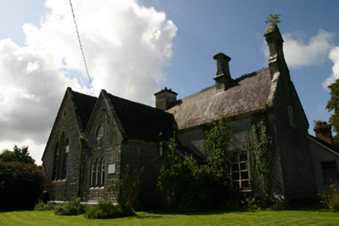 school844 yd
Explorer Tom The School in Tiraloughan handles nosy neighbours by pretending to be a castle, which works brilliantly because nobody…
 Lough Cutra CastleGate lodge · 931 yd
Explorer Tom Lough Cutra Castle in Galway is jealous of its famous cousin up the road. It’s just a gate lodge but it acts like it’s…
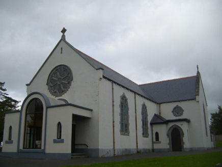 Saint Anne's Catholic ChurchChurch/chapel · 1211 yd
Explorer Tom Saint Anne's Catholic Church took about three million cups of tea to build, or so the builders claimed in 1890. The…
 St. Annes CemeteryGraveyard · 1353 yd
Explorer Tom St. Annes Cemetery in Ashfield Demesne has an escape plan involving a very fast horse and no map. It was the first…
 Ardamullivan Castle (in ruins)Castle, tower house · 1356 yd
Explorer Tom Ardamullivan Castle in County Galway had a real drama in 1579 when two men killed each other over who got to live…
 Mapped cemeteryCemetery · 1543 yd
Explorer Tom Mapped cemetery in County Galway is sick of being asked if there are ghosts living under the third row from the left.…
 Standing stone in Laughil (kiltartan By.)Standing stone · 1737 yd
Explorer Tom Standing stone in Laughil would tell its younger self to stop trying so hard to stand upright and just relax for once.…
 Country house in Lough Cutra DemesneCountry house · 1.0 mi
Explorer Tom Country house in Lough Cutra Demesne would post a selfie with a 'whoosh' emoji right now. It’s fancy but clearly lost…
 Fairy fort / earthen ringfort in Cregboy (beagh Ed)Fairy fort / earthen ringfort · 1.2 mi
Explorer Tom Fairy fort / earthen ringfort in Cregboy sits on a low hill looking at a turlough. It’s got three banks, which is a lot…
 bridge1.4 mi
Explorer Tom Bridge in Ballyboy has very strong opinions on modern buildings, which it finds to be lazy. It’s proud of its…
 Bullaun stone in CaherbroderBullaun stone · 1.7 mi
Explorer Tom Bullaun stone in Caherbroder was saved by a hero nobody remembers who threw a pie at an intruder. It sits alone…
More archaeology and monuments in County Galway · All of County Galway

What do you know about this place?Tap to add a comment or ask a question