
Places near here
Photo credits
- National Inventory of Architectural Heritage
- Kmcnamee, Wikimedia Commons · CC BY-SA 4.0
- Garry Dickinson, Geograph · CC BY-SA 2.0
- Mike Searle, Wikimedia Commons · CC BY-SA 2.0
- Harold Strong, Geograph · CC BY-SA 2.0
- A.-K. D., Wikimedia Commons · CC BY-SA 4.0
- Created by Kglavin Modified Aug 2007 by Mike Christie, Wikimedia Commons · CC BY-SA 3.0
- Unknown author Unknown author, Wikimedia Commons · Public domain
Explorer Tom Garbally Well is locked in a bitter feud with the nearest tree, which keeps dropping leaves into its cup like an…
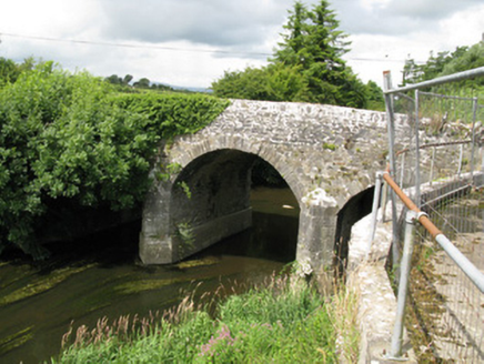 Broken BridgeBridge · 1422 yd
Explorer Tom Broken Bridge in Cloonpasteen has a superstition that if you cross it at midnight, you’ll find your lost keys somewhere…
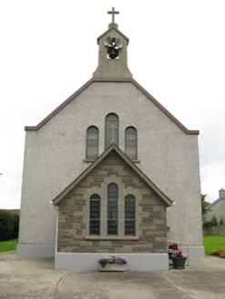 Saint Ita's Catholic ChurchChurch/chapel · 1.2 mi
Explorer Tom Saint Ita's Catholic Church in Kilmeedy is having a fairy dispute over who gets to park first. The bellcote is…
 Quaid Park, Feohanagh/CastlemahonGAA ground · 1.5 miMoated site in AhaveheenMoated site · 1.7 mi
Explorer Tom Moated site in Ahaveheen has a long list of former names, most of which were forgotten before they were even spoken…
Feenagh/Kilmeedy GAA pitchGAA ground · 1.8 mi Castle MahonCastle · 3.2 mi
Explorer Tom Castle Mahon inspired a bad poem by someone who clearly didn't know how to rhyme with 'stone'. The verse was so awful…
 Springfield CastleBawn · 3.6 mi
Explorer Tom This Bawn at Springfield is on a strict diet, giving up all its mystery for Lent. It’s so attached to the house that…
 National Co-op MuseumMuseum · 4.6 mi
Explorer Tom The National Co-op Museum is basically where everyone got together to share their bread and butter, and probably some…
 Saint Ite's WellSpring · 5.8 mi
Explorer Tom Saint Ite's Well is a tiny hole covered with a grate, basically complaining to the council about lack of funding for…
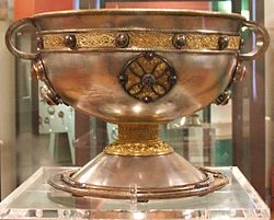 Ardagh FortArchaeological place · 8.3 mi
Explorer Tom Ardagh Fort got the name wrong on the map because the cartographer was too busy thinking about lunch. It stands there…
 Battle of LiscarrollMajor battlefield · 11 mi
Explorer Tom Battle of Liscarroll in County Cork is where two armies had a massive row in 1642, and honestly, I think they just…
More archaeology and monuments in County Limerick · All of County Limerick

What do you know about this place?Tap to add a comment or ask a question