
What is recorded here
From the National Monuments Service (Archaeological Survey of Ireland) record KD035-003002
Places near here
Photo credits
- Maker not stated on source page, en.wikipedia.org
- National Inventory of Architectural Heritage
- Maker not stated on source page, id.pinterest.com
- Thenameisrob, Wikimedia Commons · CC BY-SA 4.0
- Maker not stated on source page, allthatsinteresting.com
- Kmcnamee, Wikimedia Commons · CC BY-SA 4.0
- Mike Searle, Wikimedia Commons · CC BY-SA 2.0
- Maker not stated on source page, br.pinterest.com
 Church (Site of)Church · 22 yd
Explorer Tom Church in Tyrrellstown is basically a raised bump where the walls fell over and gave up. A cow tried to buy it last…
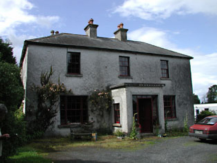 Moatstown HouseMiller's house · 806 yd
Explorer Tom Moatstown House in Moatstown has a local who claims he invented the concept of a miller’s house, which is quite…
 CastleCastle, unclassified · 1173 yd
Explorer Tom Castle in Belview Srowland is being judged by the rabbits who think it’s a really fancy hill. It was a town and castle…
 Church in Bert DemesneChurch · 1230 yd
Explorer Tom Church in Bert Demesne is hiding from the mapmakers like a shy cat under a sofa. It was on an old map, but nobody can…
 Milltown BridgeBridge · 1303 yd
Explorer Tom Milltown Bridge over the canal is where two lovers once argued so loudly the stones themselves seemed to cringe and…
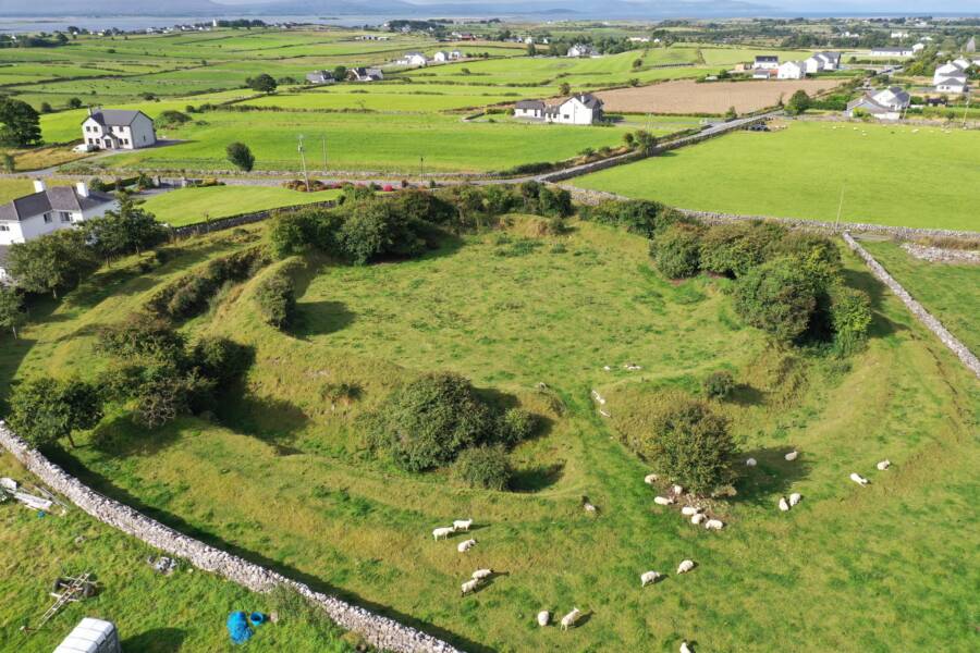 Fairy fort / earthen ringfort in SrowlandFairy fort / earthen ringfort · 1316 yd
Explorer Tom Fairy fort / earthen ringfort in Srowland would handle a nosey neighbour by pretending to be a gentle slope and…
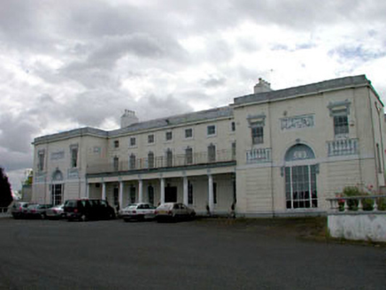 Bert HouseHouse · 1321 yd
Explorer Tom Bert House in Bert Demesne thinks Dublin tourists are loud, messy, and slightly damp. It’s a massive Classical beast…
 Castlemitchell GAA pitchGAA ground · 1521 ydRheban GAA pitchGAA ground · 1.1 mi
 Reban CastleCastle, Anglo-Norman masonry castle · 1.3 mi
Explorer Tom Reban Castle was designed by a mother-in-law who wanted everyone to watch her over the river Barrow. It’s been guarding…
 Mapped graveyardGraveyard · 1.4 mi
Explorer Tom It has an imaginary twin across the sea in this mapped graveyard in Kildare that talks to it during high tides every…
Graveyard in Oldcourt (bert Ed)Graveyard · 2.0 miExplorer Tom Oldcourt’s graveyard got carted off by a greedy shopkeeper to fertilize his crops, so basically everyone is now…
More archaeology and monuments in County Kildare · All of County Kildare

What do you know about this place?Tap to add a comment or ask a question