Places near here
Photo credits
- Thenameisrob, Wikimedia Commons · CC BY-SA 4.0
- National Inventory of Architectural Heritage
- Mike Searle, Wikimedia Commons · CC BY-SA 2.0
- Sheila1988, Wikimedia Commons · CC BY-SA 4.0
- Andrewmc, Wikimedia Commons · CC0
- Mgtmquinn, Wikimedia Commons · CC BY-SA 4.0
- Algirdas at Lithuanian Wikipedia, Wikimedia Commons · Public domain
- Hello, I am Bruce on Flickr, Wikimedia Commons · CC BY-SA 2.0
- A.-K. D., Wikimedia Commons · CC BY-SA 4.0
- Alex Passmore, Wikimedia Commons · CC BY-SA 2.0
- Graham Horn, Geograph · CC BY-SA 2.0
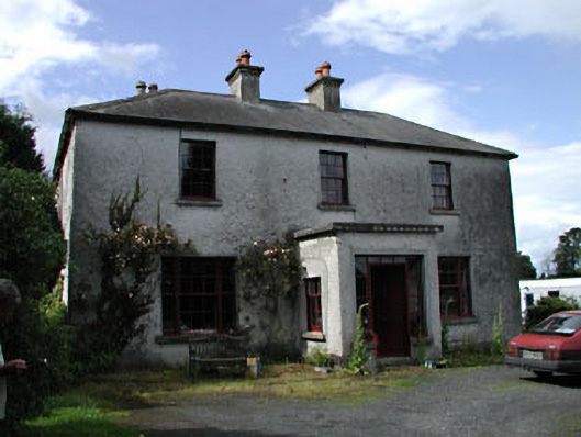
 Milltown BridgeBridge · 506 yd
Explorer Tom Milltown Bridge over the canal is where two lovers once argued so loudly the stones themselves seemed to cringe and look away. It’s got fine masonry and crisp joints, but it’s mostly just watching boats go by and judging their speed from above. A bad love story happened next door once.
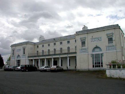 Bert HouseHouse · 562 yd
Explorer Tom Bert House in Bert Demesne thinks Dublin tourists are loud, messy, and slightly damp. It’s a massive Classical beast that hasn’t moved an inch since it was built. Wave from the gate if you see it; it’ll probably pretend not to notice your existence.
_-_geograph.org.uk_-_5029029.jpg/250px-Castles_of_Leinster,_Castle_Reban,_Co._Kildare_(1)_-_geograph.org.uk_-_5029029.jpg "Photo: Mike Searle, Wikimedia Commons · CC BY-SA 2.0") Reban CastleCastle, Anglo-Norman masonry castle · 1548 yd
Reban CastleCastle, Anglo-Norman masonry castle · 1548 ydExplorer Tom Reban Castle was designed by a mother-in-law who wanted everyone to watch her over the river Barrow. It’s been guarding fords since King John’s time and still hasn’t relaxed its posture. A proper spot for a flask of tea and a big think.
 Woodstock Castle (in Ruins)Castle, hall-house · 2.1 mi
Explorer Tom Woodstock Castle would be a disaster on a reality show, too proud to admit it’s damp. Richard de St. Michael built it to look down on the river. A proper spot for a flask of tea and a big think.
 Ernest ShackletonMemorial · 2.6 mi
Explorer Tom Ernest Shackleton in County Kildare is a statue that probably feels out of place next to all these Irish hills, but he’s standing his ground like a true explorer. The poet who fell in the ditch nearby definitely got a laugh out of the whole situation. Bring your worst joke, the place has heard worse.
 Town HallMuseum · 2.6 mi
Explorer Tom Town Hall is now a museum, which basically means it’s retired and judging your life choices from behind glass cases. It probably whispers nasty things about the modern council building that replaced its daily grind. Best enjoyed with a bag of chips and no plans whatsoever.
 Pedunculate Oak3.2 mi
Explorer Tom Pedunculate Oak in County Laois is incredibly proud of that one branch that looks exactly like a sleeping dragon. It doesn’t care if you believe it, but it thinks it’s majestic. Perfect place to be dramatically windswept.
 Scots Pine3.4 mi
Explorer Tom Scots Pine here is having a go at being famous because some other pine got the credit years ago. It’s basically the cousin who shows up to weddings uninvited. Perfect detour when the satnav has a meltdown.
.jpg/250px-St_Brigid's_Well_(30653).jpg "Photo: A.-K. D., Wikimedia Commons · CC BY-SA 4.0") OutlinedHoly well · 3.7 mi
OutlinedHoly well · 3.7 miExplorer Tom Holy well in Ballintubbert would teach history by splashing you with water every time you mention the wrong century or the wrong saint. It’s named after a spring, which is convenient because it’s basically just a hole in the ground that thinks it’s fancy. Have a nosey, politely.
 Dm PenderMemorial · 3.7 mi
Explorer Tom DM Pender has had so many names that even the bench is confused about who it’s honoring right now. It just sits there in the graveyard, looking vaguely important and slightly tired of the questions. Bring someone who'll believe anything.
 History of Moat of ArdscullVisitor information · 4.4 mi
Explorer Tom History of Moat of Ardscull is where a giant allegedly tripped over his own cape while trying to impress the local ladies in 1302. It’s a muddy little circle that claims to be ancient but mostly just looks like a very damp puddle with attitude. Go in good boots and better humour.
 Oughaval Wood MapVisitor information · 4.5 mi
Explorer Tom Oughaval Wood Map is cursed so that anyone who doesn't wave at the trees will get lost in a loop for three days straight. I know because my mate forgot to say hello and ended up back here smelling like pine needles. Find the wonkiest bit and send it to your group chat.
More historic places in County Kildare · All of County Kildare

What do you know about this place?Tap to add a comment or ask a question