Places near here
Photo credits
- National Inventory of Architectural Heritage
- Kenneth Allen, Geograph · Creative Commons Attribution-ShareAlike 2.0
- Kenneth Allen, Wikimedia Commons · CC BY-SA 2.0
- Andreas F. Borchert, Wikimedia Commons · CC BY-SA 4.0
- Wanfried-Dublin, Wikimedia Commons · CC BY-SA 4.0
- danny kearney, Wikimedia Commons · CC BY-SA 2.0
- Kenneth Allen, Geograph · CC BY-SA 2.0
- Greg Clarke, Wikimedia Commons · CC BY 2.0
- Picture: Wild Ireland
- N Chadwick, Wikimedia Commons · CC BY-SA 2.0
- Richard Webb, Wikimedia Commons · CC BY-SA 2.0
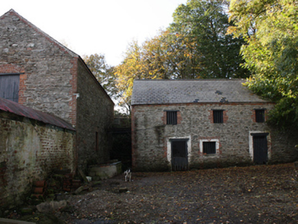 outbuilding294 yd
Explorer Tom Outbuilding in Three Trees has cast-iron mechanical cog wheels staring out from its south wall like a surprised beetle. Built c. 1830 and c. 1870, I reckon those gears are still ticking quietly, waiting for someone to wind up the whole farm.
 Greenbank Presbyterian ChurchChurch/chapel · 1413 yd
Explorer Tom Greenbank Presbyterian Church dates to 1862, with stained glass set into cast-iron windowwork. I thought the old stone walls were doing all the heavy lifting, then the windows showed me iron has a job too. The colours get the applause.
 Quigley's PointHeadland · 1.4 mi
Explorer Tom Near Quigley's Point, United States Navy seaplanes flew from a Lough Foyle base in 1918. It closed by February 1919, after crews had built roads, hangars and slipways; quite a lot of building for such a short stay.
 Eskaheen GraveyardGraveyard · 3.0 mi
Explorer Tom Eskaheen Graveyard lies on high ground looking over Lough Foyle. The earlier survey recorded part of the old church's west gable and a small south wall section, with an opening that might have been a door or window. I want to leave that uncertainty in: 4.4 metres of stone can tell us plenty, but cannot name every missing part.
.jpg/250px-Eskaheen_(2).jpg "Photo: Wanfried-Dublin, Wikimedia Commons · CC BY-SA 4.0") Eskaheen Portal TombPortal tomb · 3.4 mi
Eskaheen Portal TombPortal tomb · 3.4 miExplorer Tom Eskaheen Portal Tomb carries an enormous five-metre roofstone above its chamber. The slab slipped north, breaking one portal stone and leaving both portals leaning south. Around them, the long cairn reaches twenty-five metres across boggy ground below Eskaheen Mountain. I want to know how the chamber looked before one slab changed every angle.
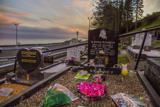 Drung GraveyardBurial ground · 3.6 mi
Explorer Tom Drung Graveyard sits on a plateau above Lough Foyle, hiding the ghost of an old ringfort. The earthworks are mostly gone under the headstones, leaving just faint curves to the north and east. It’s a layer cake of history that time has flattened out.
 Squealin' PigPub · 3.6 mi
Explorer Tom Squealin' Pig is hogging the main road so badly the pigs are squealing at the traffic. The next village claims they invented the squeal, but I doubt it. Go have a dramatic phone call from the pavement!
 FinnegansPub · 3.7 mi
Explorer Tom Finnegans sits right next to Squealin' Pig on the main road, sharing the spotlight like stubborn toddlers. Pick one and commit, or you'll get lost in the gossip. Have a wander and a wonder over there.
 Muff ForestWoodland walk · 3.7 mi
Explorer Tom Muff Forest's Grania's Gap Loop climbs from Lisnagra Woods to views over Lough Foyle. Sport Ireland marks 6.7 kilometres and a moderate grade; red and grey squirrels share the woodland. Quite a lot of company for one loop.
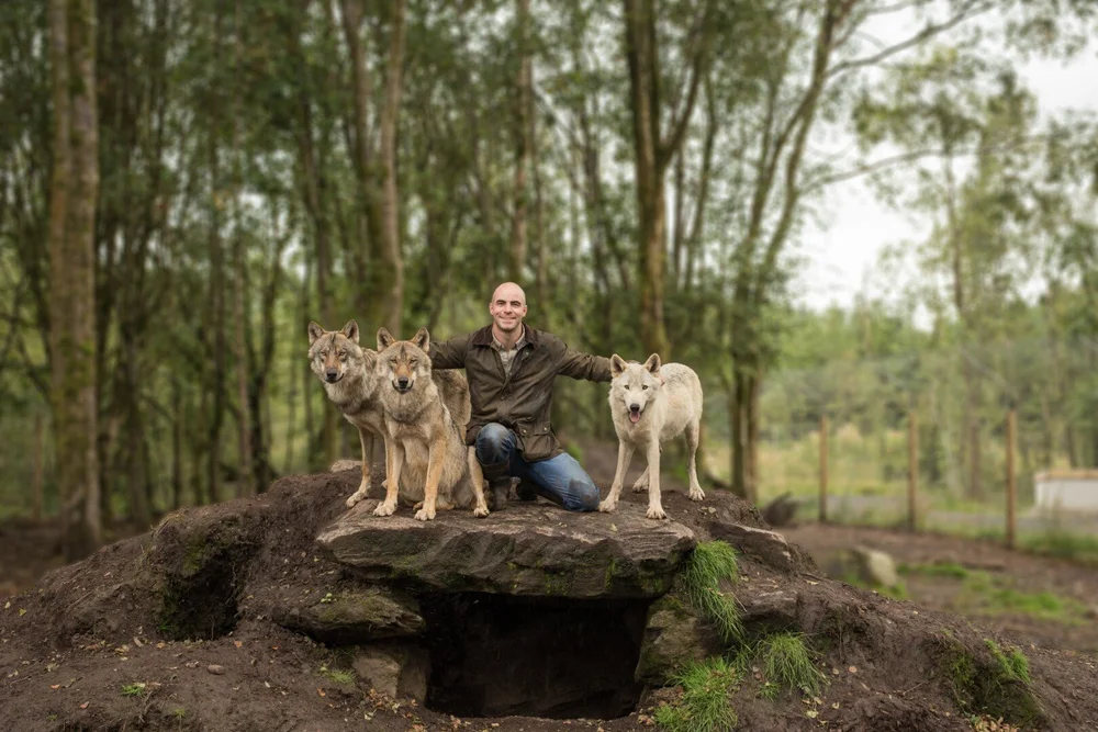 Wild IrelandWildlife sanctuary and family attraction · 6.3 mi
Explorer Tom Wild Ireland in County Donegal has a five-year retirement plan that involves moving to the sun and refusing to be woken up by any of its animal guests, which is fair after all those years of barking. It’s a wildlife sanctuary, but it dreams of being a beach club where everyone just naps and eats ice cream. Go on a wet day, it suits the mood.
 Bay Road ParkPark · 7.4 mi
Explorer Tom Bay Road Park in County Derry is having a massive drama with the nearest tree because it thinks the tree is stealing all of its sunlight and attention from passersby. The park wants to be the star, but the tree just stands there looking cool and unbothered while the grass gets trampled underfoot. Have a sandwich here and call it a heritage lunch.
 Slieve SnaghtMountain / peak · 7.4 mi
Explorer Tom Slieve Snaght has a Donegal namesake, and I have already nearly sent somebody to the wrong mountain. This one rises 615 metres in the middle of Inishowen. Its name means snow mountain, with a tradition that snow once lingered near the top until late May. In 1825, surveyors camped here and shone a bright limelight towards Divis, 108 kilometres away, for Ireland's great mapping survey. I would have preferred a kettle and a very long extension lead. There is also a holy well near the summit and a Lughnasa climbing tradition. Treat those stories and places respectfully; plan a proper hill walk with weather, navigation and safe access checked. From up high, the peninsula opens on both sides. You will know which Slieve Snaght you climbed when you see that view.
More archaeology and monuments in County Donegal · All of County Donegal

What do you know about this place?Tap to add a comment or ask a question